GR R2: the must-do hike in Reunion Island!

The must-do hike in reunion island!

With 3 extraordinary cirques, incredible vegetation, stunning peaks and ocean as far as the eye can see, Reunion Island is the ultimate hiker's paradise.

I dreamt of walking across the island from north to south, following the trek called "GR R2", and I did it! And as I explored it, I began to understand why it was called the "intense island." Shall I tell you about it?

Some information about this trek in reunion island

  • Duration of a trek

    Duration

    12 days maximum

  • Distance of a trek

    Distance

    160 km (excluding variants)

  • Elevation of a trek

    Elevation

    10,000 d+ and d-

  • Difficulty intermediate level

    Difficulty

    Intermediate level

  • high altitude hiking in reunion

    Highest point

    Piton des Neiges - 3070m

  • Best time to travel

    Best time of year for this trek

    All year round, excluding January to April (hurricane season)

My route along the reunion island

Trek undertaken from 12th to 20th november 2021

Day 1 > Stage 1: St-Denis - Roche Écrite refuge
Day 2 > Roche Écrite summit (variant) and stage 2: gîte de la Roche Écrite refuge - Dos d’ ne
Day 3 > Stages 3 and 4: Dos d’ ne - Aurère - Grand Place
Day 4 > stages 5 and 6: Grand Place - Roche Plate - Marla
Day 5 > Stages 7 and 8: Marla - Cilaos - gîte de la Caverne Dufour refuge
Day 6 > Piton des Neiges summit (variant) and stage 9: Caverne Dufour - Bourg-Murat
Day 7 > Stage 10: Bourg-Murat - gîte du Volcan refuge
Day 8 > Stage 11: gîte du Volcan - gîte de Basse Vallée refuge
Day 9 > Stage 12: gîte de Basse Vallée refuge- Basse Vallée

GR R2: the must-do hike in Reunion Island!

The "gr r2" trek: who's it for? what's special about it?

If you like the great outdoors and unspoilt countryside, this trek is for you! Spoiler alert: I was amazed by the magnificence of the scenery and variety of landscapes. Jungles with lush vegetation, volcanic and lunar landscapes, dense pine forests, lush plains, dozens of streams and waterfalls, all on an amazing scale. In a word, awesome!
And is it hard? Well, it's roughly a 160 km trek - not counting possible variants - with 10,000 m of cumulative ascents and descents, so it's a test of endurance. The challenge lies in the number of steps (by which I mean thousands), typical of Reunion trails. And they're all different sizes which made it more fun. I'll tell you more about it later...
There were also huge numbers of roots and stones, and cliff paths so you had to be constantly vigilant about where to put your feet. People say that some sections are very muddy but it was very dry when we were there so I can't confirm that.
But unlike the GR20, to cite just one example, there were fewer vertiginous sections where you had to use your hands or climb with a rope. Which, in my opinion, made it less difficult.
Another thing to be aware of: the altitude, particularly if you do the variants (up to 3,000 m+), so you'll need to take nice, warm clothes.
Finally, the Reunion weather can come as a surprise. We were extremely lucky in this regard but it can quickly become overcast, sometimes as early as 10 or 11 am. So one word of advice: start walking early! The good news is that the sun rises at roughly 5.30 am.
So there you have it; you've been warned.

Stage 1 > hike from saint-denis to gîte de la roche écrite refuge

16KM // 1800 D+ // 5.5 HRS

Let's go! After a good night's sleep - essential after our previous night in the airplane - we were now at the start of the GR R2. I'd dreamt about it and I was there! Today was all about climbing: 1800d+ awaited us. The start of the trail took us seamlessly from the town to the forest. The incline was quite gentle, nothing too difficult. We already found ourselves surrounded by vegetation ...and steps. We also got to enjoy some superb views of the ocean.
After 2 hours of walking we arrived at Le Brûlé, an unassuming little village. Lots of hikers start their trek here but we're purists. We filled up our water bladders and set off for a hour of climbing along tarmacked road - not the best part of the day...The best part was yet to come: we entered the Roche Écrite Nature Reserve, following a small trail that alternated between dense jungle and bamboo forests. The sound of tweeting birds added to this moment of bliss, particularly the Tuit-tuit (Reunion cuckooshrike), an extremely rare bird that you only find on the island. We felt great, even high up in the clouds!
We walked briskly until we reached the gîte de la Roche Écrite refuge, the end of the first stage which set the tone for this adventure. It was a quiet, rural gîte, surrounded by vegetation. It would have been perfect if there'd been hot water but we had to make do with a cold shower. The evening meal - beef curry - was very good, as was the bed that awaited us.

Guesthouse in reunion island
hike to mafate in reunion island

Roche écrite variant and stage 2 > from roche écrite to dos d’âne

10KM // 200 D+ / 900 D- // 2 HRS 45

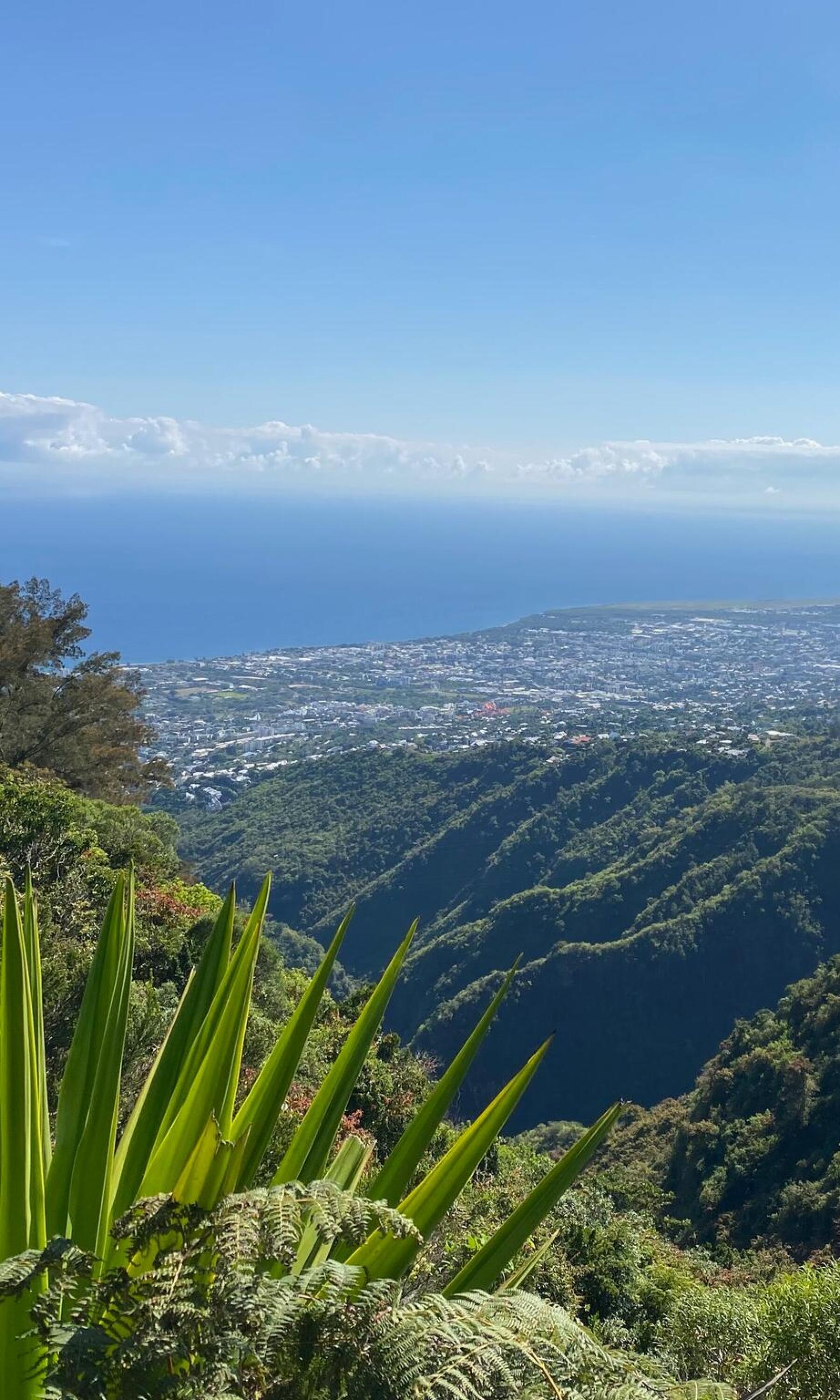
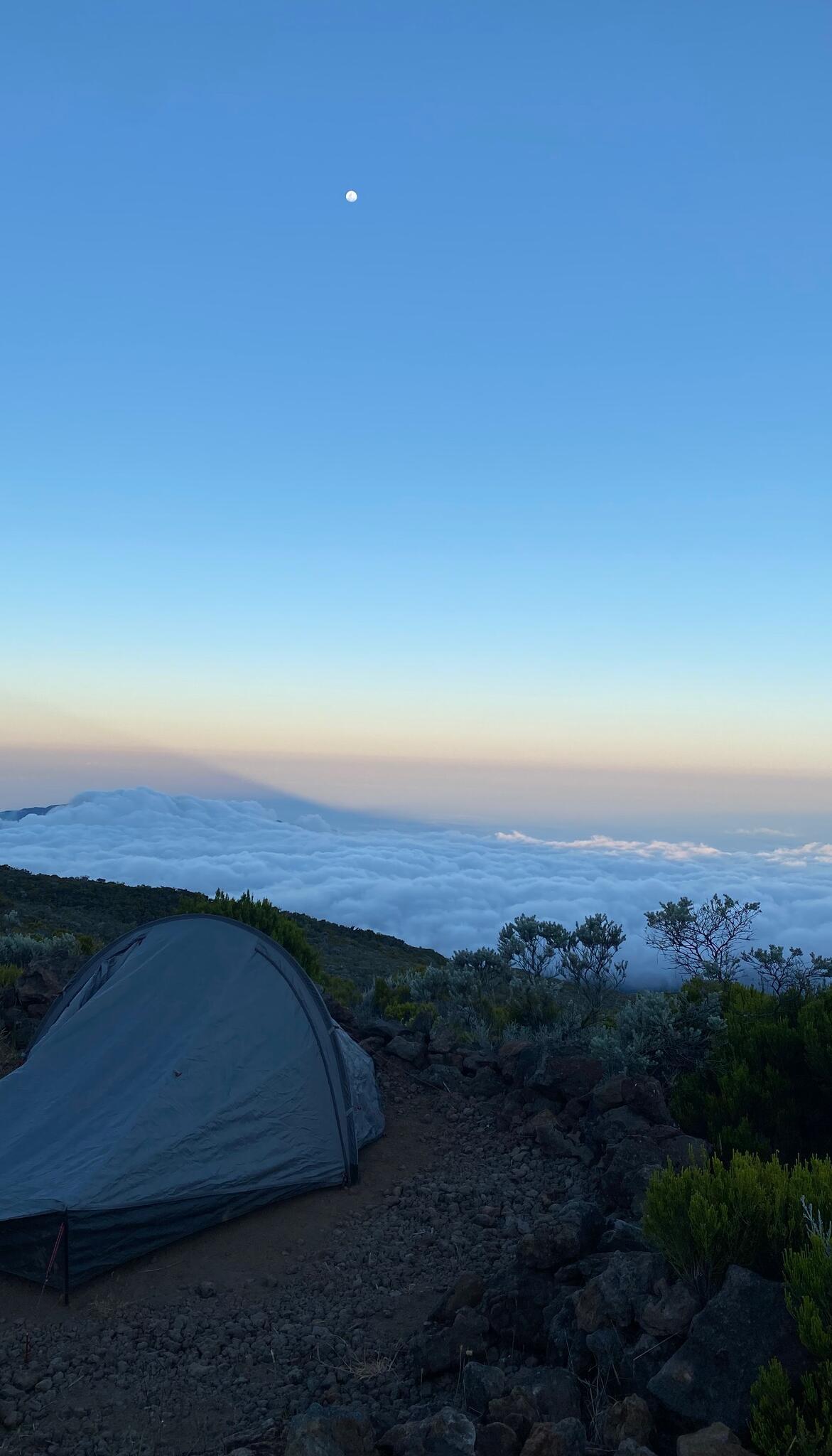
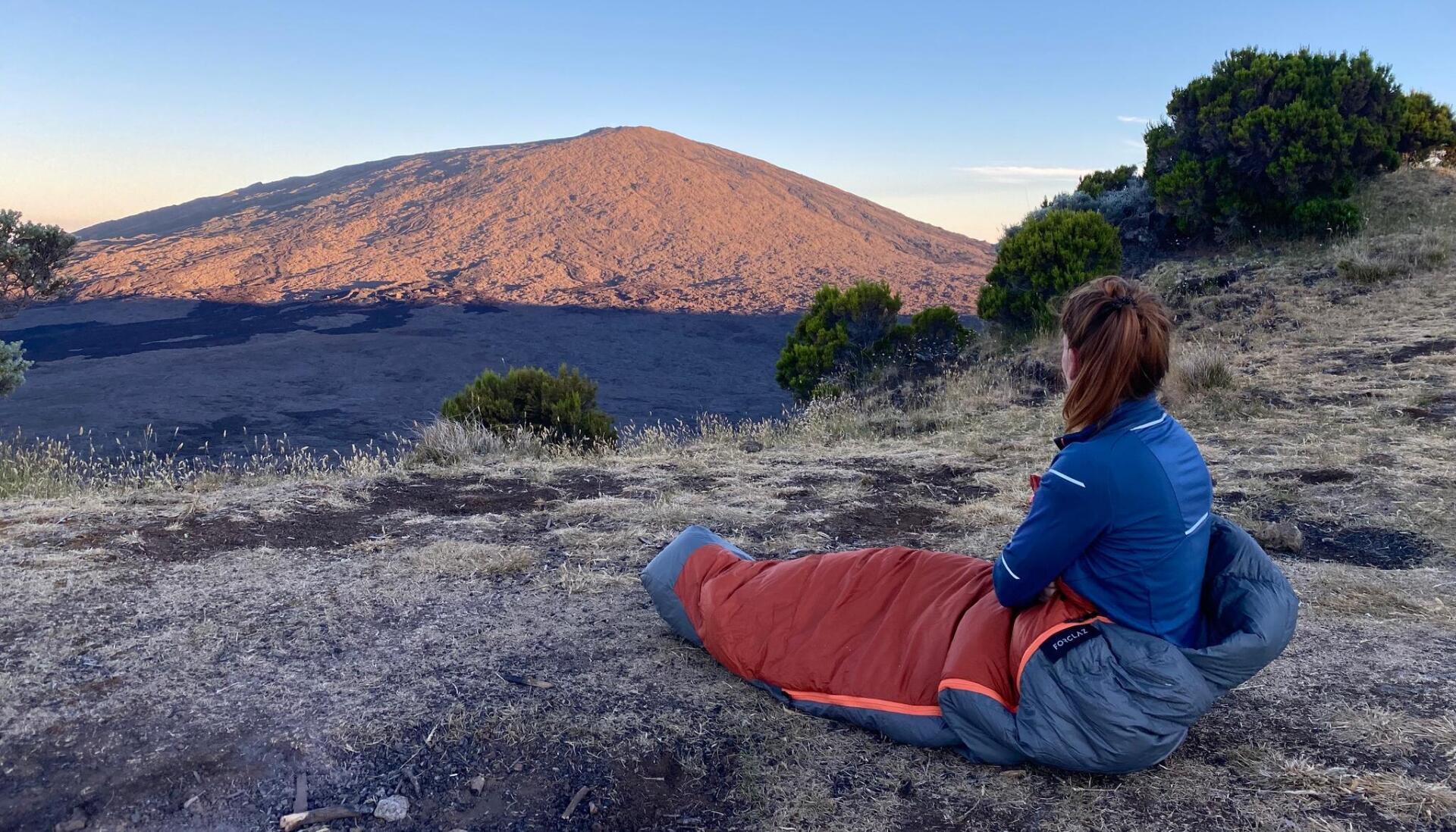
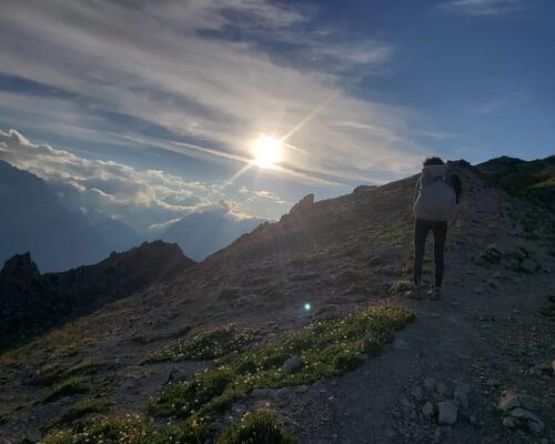
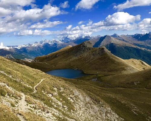
And yet, it wasn't one of the best nights. We woke up very early so we could reach the Roche Écrite summit - a stage not included in the GR trail but which is well worth the trip - before breakfast. The good thing is that we could leave our bags at the gîte and walk unencumbered. 5.30 am, we climbed for a good hour through a vast, rocky, surprisingly arid plain. You really need to pay attention to spot the trail which is marked in white. Throughout the climb, we had a fantastic, clear view of the sea with a few clouds in the distance.
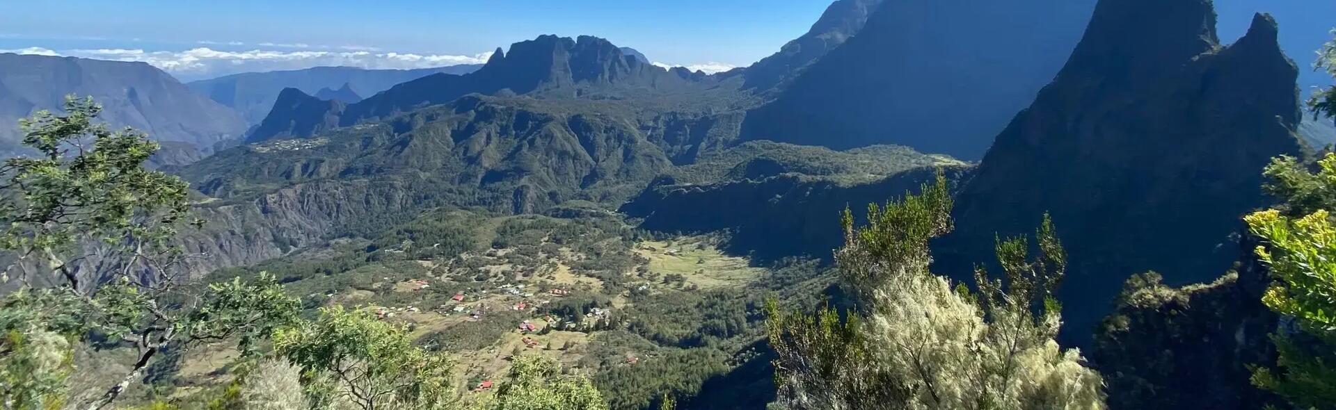
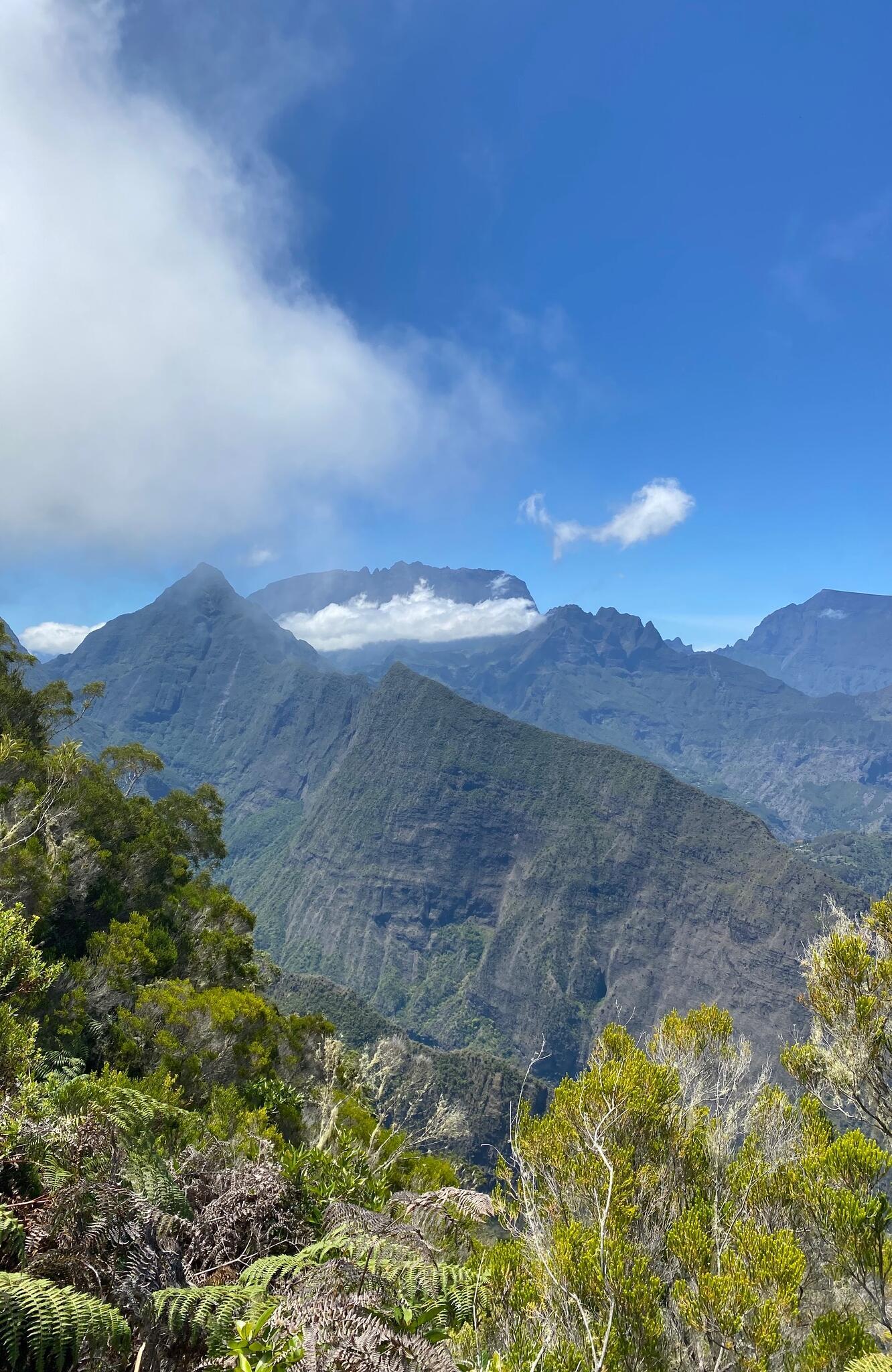
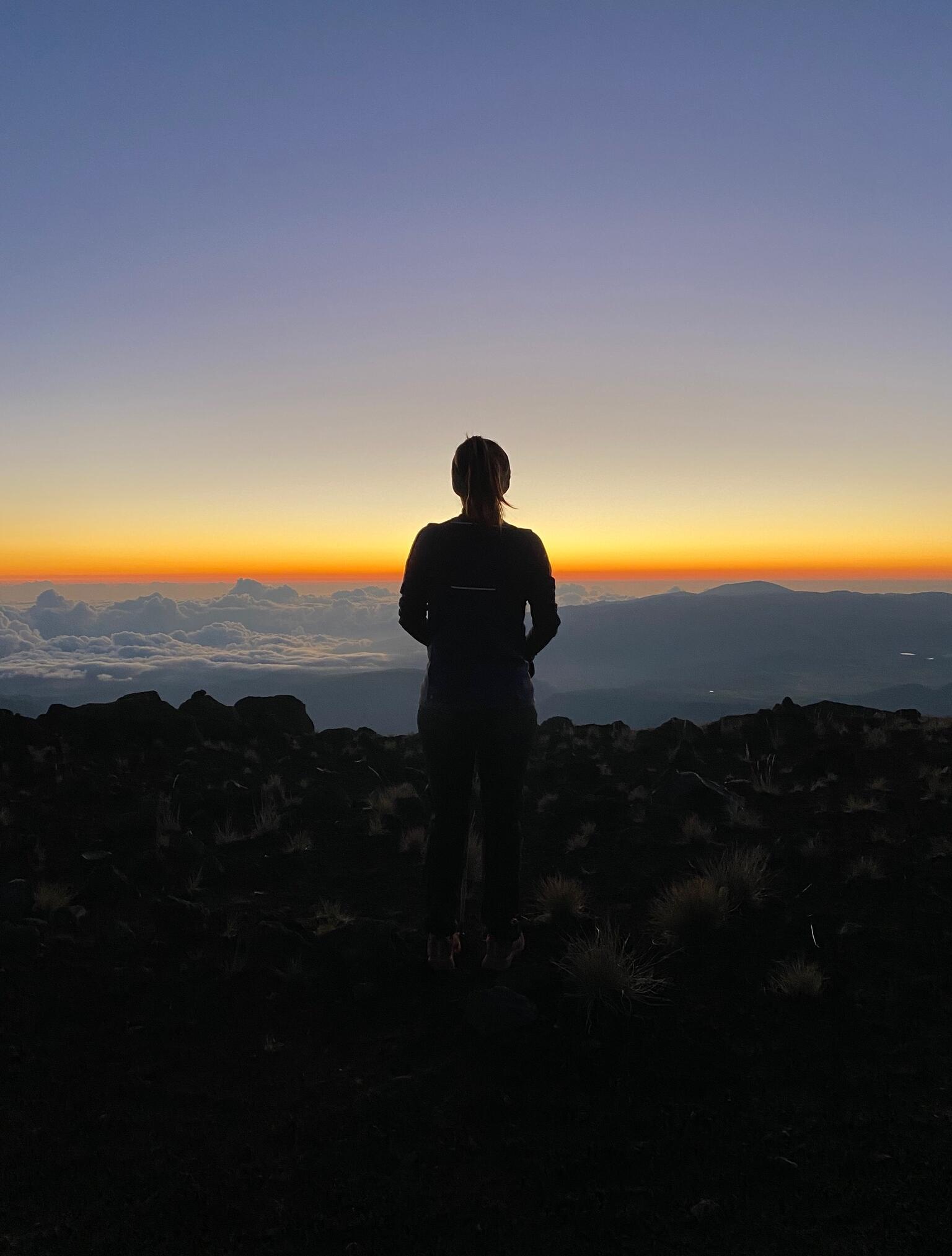
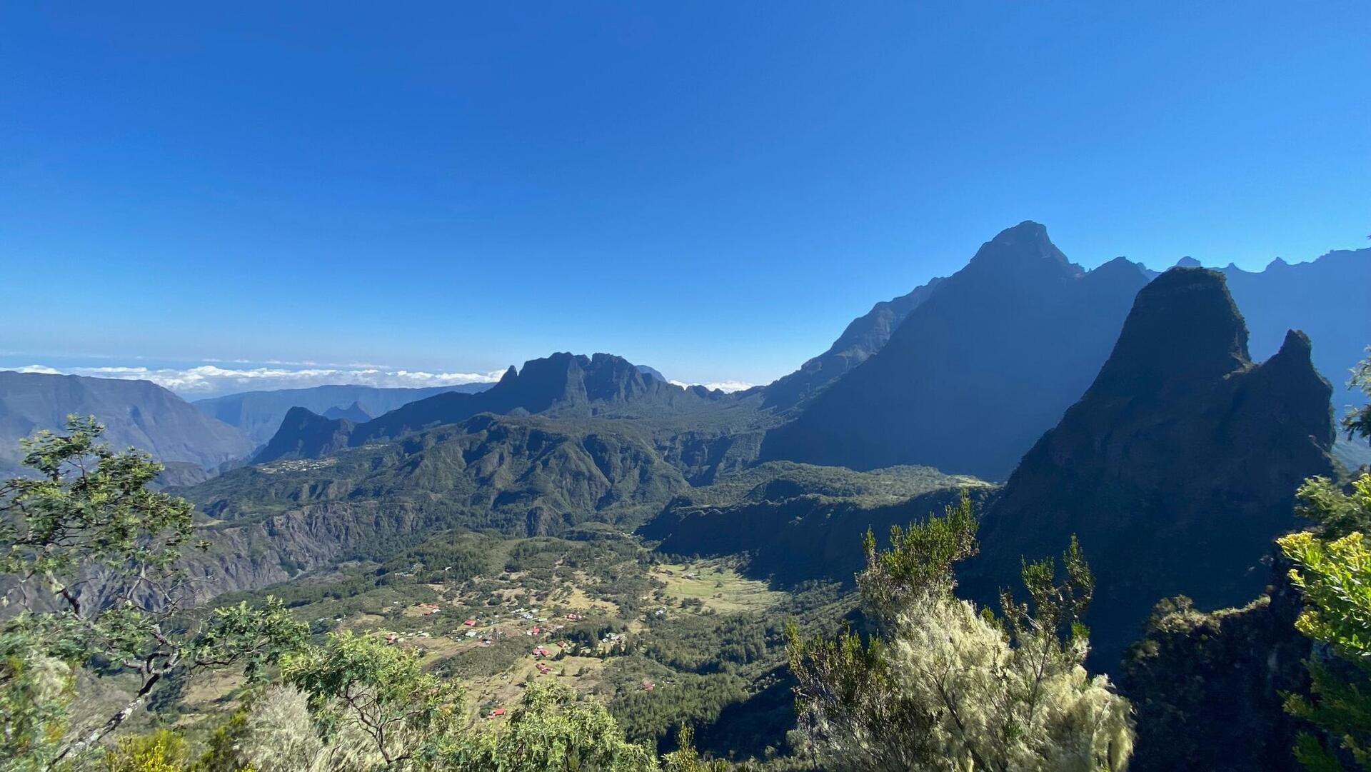
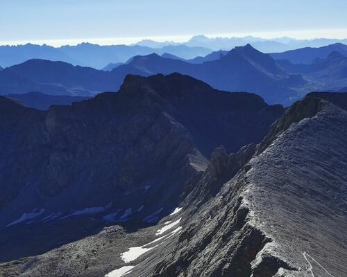
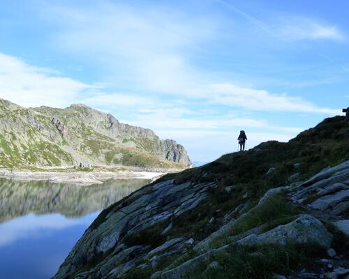
The summit, some 2,200 metres above sea level, left us speechless. There, stretching out before us was the Cirque de Salazie, with not a cloud on the horizon. In the background, we could see part of the Mafate Cirque and the 2 pitons - Piton des Neiges and the Piton de la Fournaise. It was spectacular, the steep green peaks and villages below. We spent a while admiring the amazing view and then walked back down. At 8 am sharp, we sat down for our breakfast which we devoured without even saying grace!

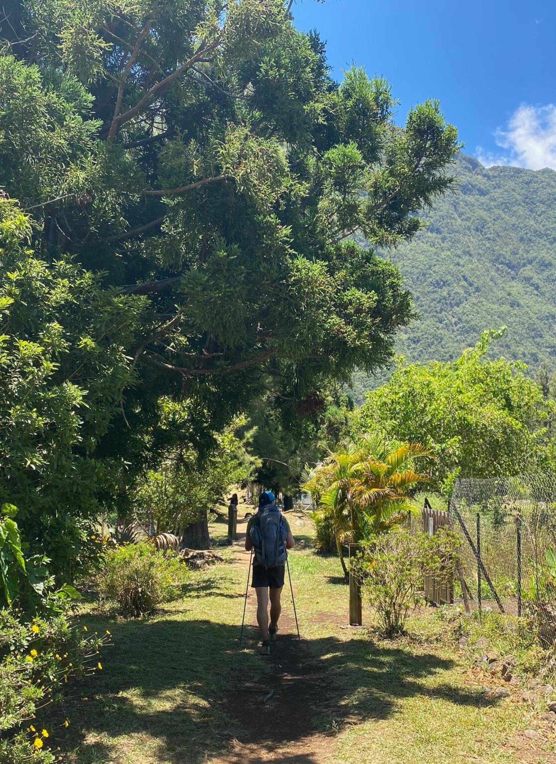
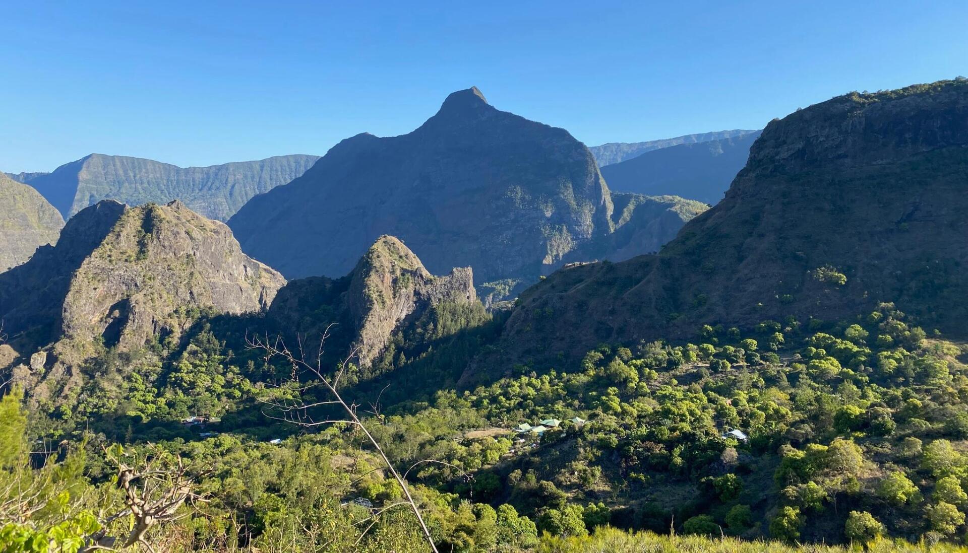
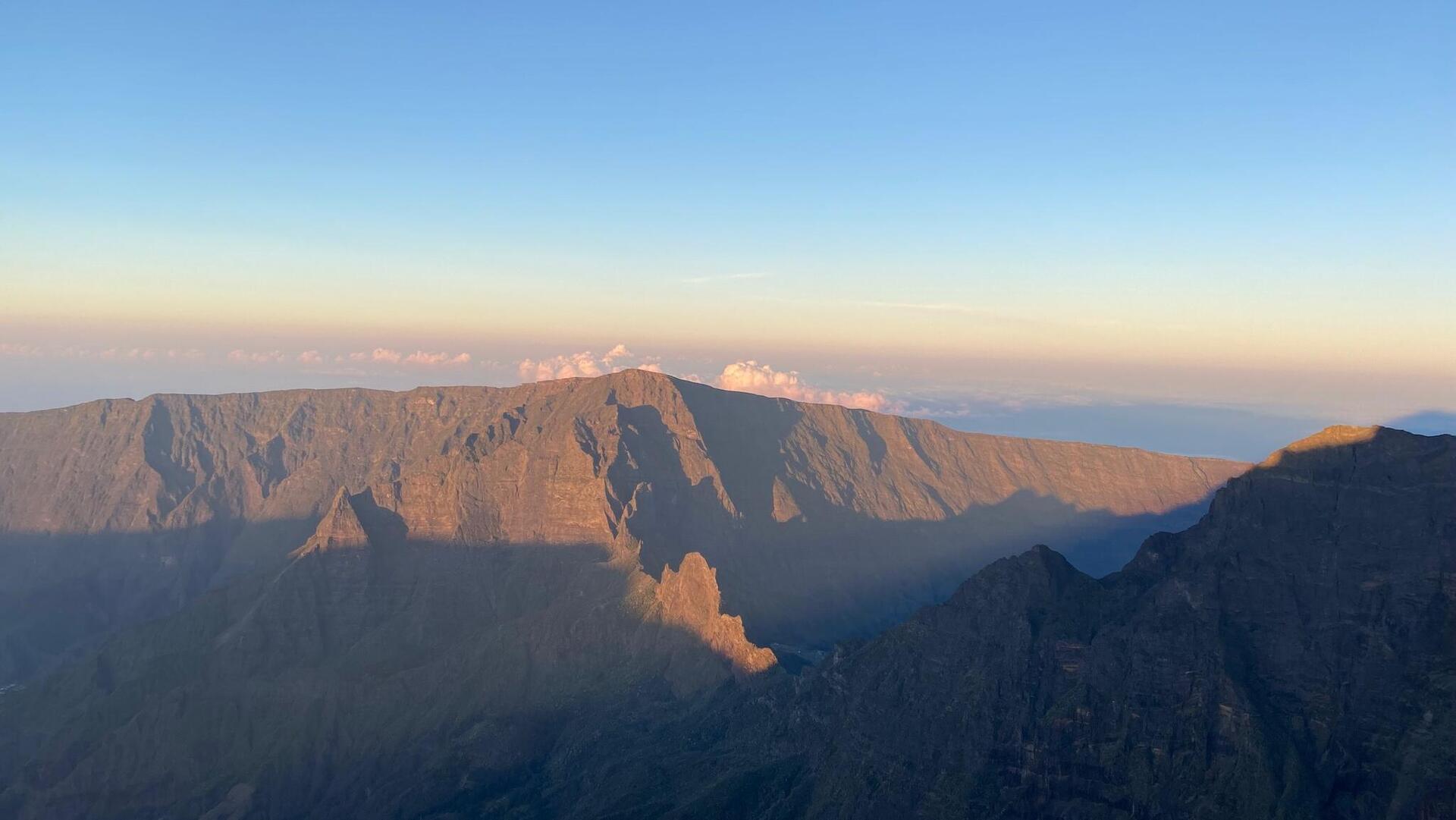
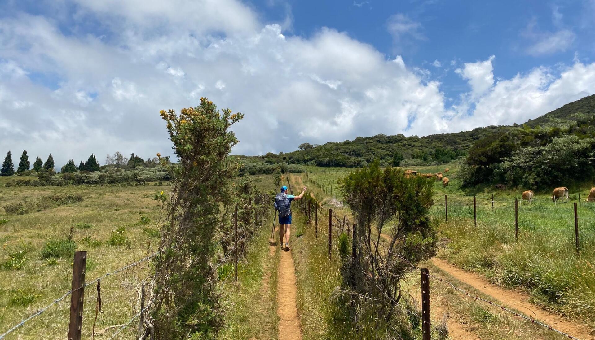
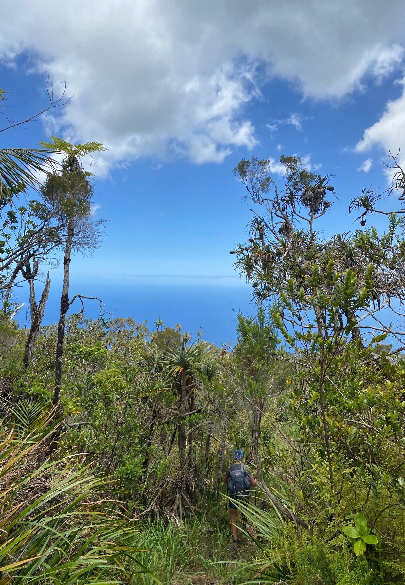
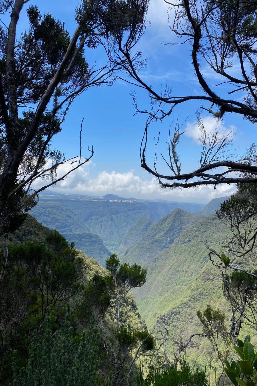
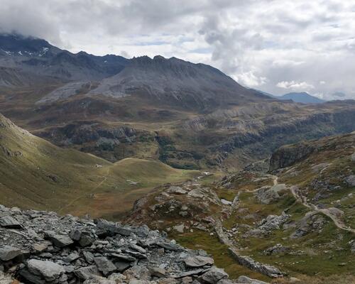
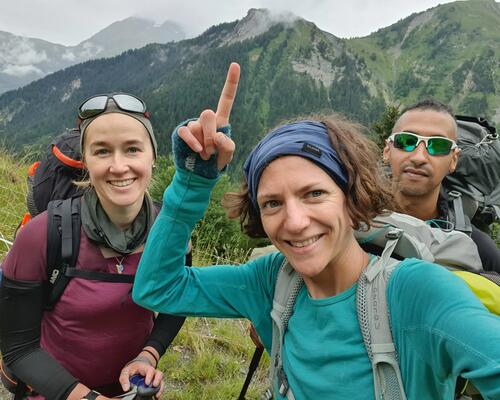
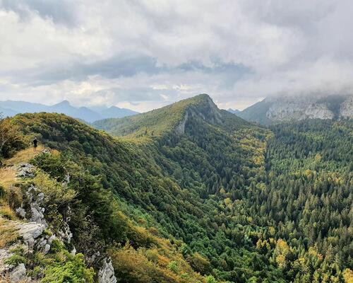
In the meantime, everyone had left the gîte and it was our turn to hit the road and follow the GR towards Dos d’Âne, one of the entry points to the Mafate Cirque. A short stage but what a stage! Certainly one of the most beautiful. First, we again walked through a dense forest, regularly lowering our heads to avoid branches and tree trunks. Soon, through the vegetation, we could make out the Cirque de Mafate on our left. It was a stunning view which remained visible as we walked all along the ridge trail. A feast for the eyes...and a workout for the legs. The guide promised us a stage that was all downhill. It lied: It was all raised mounds which we climbed up and then immediately down - a special treat.
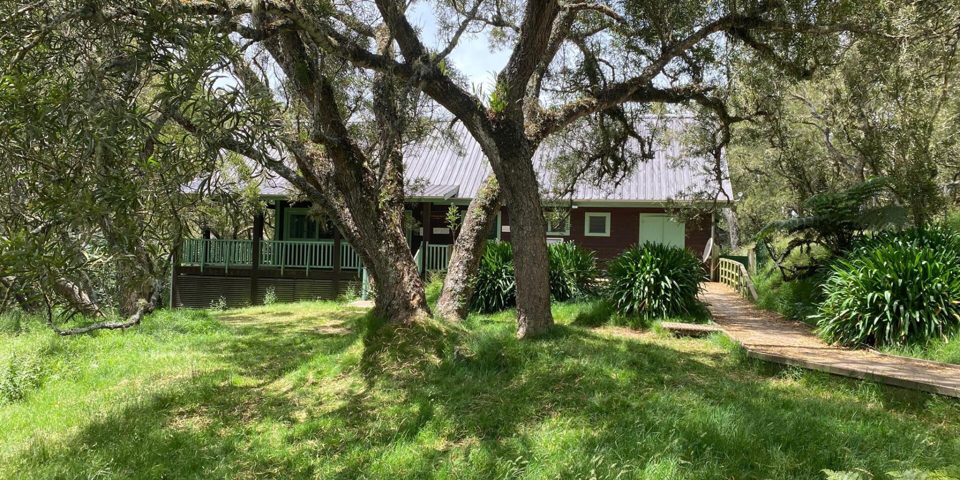
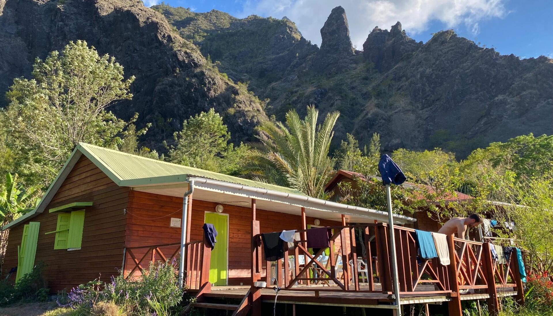
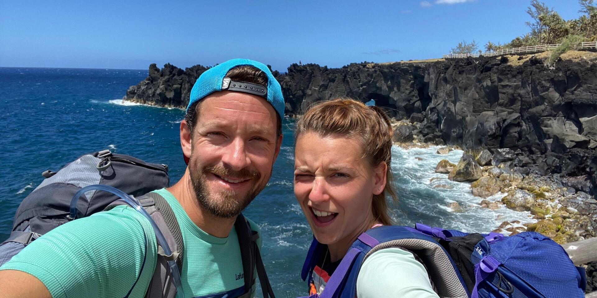
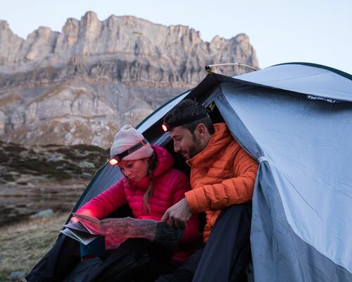
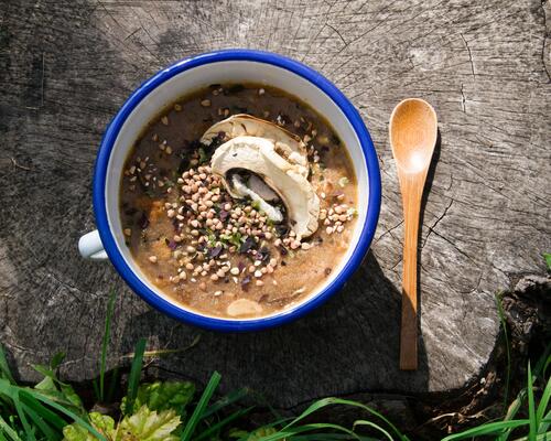
After a final superb, but steep, ridge, we reached the village of Dos d’Âne, high up in the clouds. We came across the only restaurant in the area where we feasted on "rougail saucisses," a spicy sausage stew. When we reached the refuge, we spent a while chatting to other hikers. The evening was fun and, our host had lots of advice to share about the next day.

Mafate is superb; you feel tiny when facing the vastness of nature.

trek from aurere to mafate

Stages 3 and 4 > hike from dos d’âne to aurère and grand-place

22.5KM // 1200 D+ / 1300 D- // 7 HRS 15

I slept better and at 7.15 am, we set off on our way, ready to do battle with Mafate. As it was the big day: the day of our long awaited encounter with the famous cirque. And also a day of aches and pains.
At the start of the trail, we came face to face with dozens of trail runners, competing in a race. It was nice (we were happy to encourage them) but also a bit annoying as the path descended sharply along a narrow, quite steep trail with a few "ladders" or stairs so we had to let them pass as they made their way up. That made us lose a bit of time.
Eventually, after a 2 hour descent, we reached Mafate. We stood on a plateau, surrounded by impressive mountains and traversed by the Rivière des Galets. It was superb; we felt tiny when faced with the vastness of nature. I apologize but it's difficult to describe just how beautiful it was. We crossed the river several times, taking the opportunity to cool down - which felt great in the heat of the blazing sun.
Further along we reached a forest; we were very grateful for the shade so we could tackle the challenging and impressive flight of steps that would eventually - after some 15 km and 800 d+ elevation gain - lead us to Aurère. But the reward was worth it: Aurère is cuteness personified. A tiny village, in the depths of the mountains, with a grass path running through it, colourful, well-maintained houses and a lovely bar (well, ok, it was closed but it was Sunday) where we stopped off and had a sandwich. An oasis of calm that cast its spell over us.

The day wasn't over yet; we carried on, completing a double shift, making for Grand-Place les Hauts. We walked through îlet à Malheur and îlet à Bourse, two charming villages. There was even a café in the second where we indulged in a nice cold drink. But I'm forgetting the most important thing: the trail itself which was really rather difficult, a constant up and down with (would you believe) endless steps. Fortunately the scenery was breath-taking and the sun stayed with us all day. We came across some super impressive giant bamboo.
3 hours later and we arrived at our destination. Another lovely place; the gîte was extremely quiet, surrounded by lush vegetation. We shared our dorm with 5 really friendly hikers who we spent a great evening with.
And it wouldn't be a proper night in a dorm without a snorer!

best guesthouse in reunion island

Stages 5 and 6 > from grand-place to roche plate and marla

19.5KM // 2000 D+ / 900 D- // 7.5 HRS

It was going to be a long day, so we ate breakfast quickly. The disadvantage of staying in a gîte here is that breakfast is served quite late (usually around 7am) which makes leaving at sunrise difficult...
Time to head for Roche Plate! Things didn't start quite as planned: we took the wrong path - there were several signposted in the village - we were headed towards Roche Plate but not via the GR R2. It was another marked trail which was more direct but (spoiler) just as tough. As self-confessed sticklers - but you knew that already - we were a little disappointed that we hadn't followed the "official" trail but - too bad - we didn't have time to turn around. And anyway we were too busy walking down a long, particularly steep path leading to the river... to hike back up again. And that just about sums up Mafate for you! But the scenery was still stunning which made everything seem easier. Because the steps leading to Roche Plate were a real pain and we climbed a lot of them. 3 hours and 900 d+ later, we arrived and hooked up again with the GR R2. We filled up our water bottles and set off towards La Nouvelle.

Another lovely technical descent down to the same river. This time, we had a proper break; we bathed in the cool water of the natural ponds, and snacked on sausage and cheese that we'd had the foresight to bring. It was a magnificent spot. Despite the fact that ahead of us we could see the winding path we'd need to climb to reach the village. And it was a tough ascent under a scorching sun. En route, we encountered an enormous yellow and black spider, seemingly happily sunning itself, while we counted the endless twists and turns on the trail...
Finally, we reached La Nouvelle, Mafate's largest village. We were shattered. We needed another, longer break and headed to the local snack bar where they had...chips! I couldn't have dreamt up a better meal!
Once again, it was all really charming, starting with the colourful houses, flower-filled gardens and small chapel. It looked like a film set.

Finally, for the last stage of the day: Marla; and it was starting to cloud over. We walked through a lovely pine forest although by then I was exhausted and I just had one wish: to get there. A last lot of steps to reach 1,600 m and a few natural pools before the lovely Marla.
We were at the extreme south of the cirque and felt completely cut off, as if we were at the end of the earth (to tell the truth, I was also at the end of my tether). It was so, so ,SO beautiful!
When we arrived we found a small bar where we had a drink before heading to our gîte. We spent that night in a tent set up by the gîte. And not just any tent: they'd provided a real mattress and duvet - fantastic! The water was hot, the food delicious (even though we had rice again, just like every other evening), the company was good and the surrounding view completely insane. And I won't even mention the starlit sky...

hike in reunion island
refuge in reunion island

Stages 7 and 8 > marla - cilaos -la caverne dufour refuge

23KM // 2200 D+ / 1000 D- // 8.5 HRS

It was an incredible night, the most comfortable that I've ever spent in a tent! And the view when you woke up. Wow!
I was slight dreading this day because the 2 stages we'd planned were long - and our legs were already pretty tired from the previous days - and we had to arrive before nightfall which was 6.30pm. So we set off without delay. We left Mafate early in the morning, after hiking across the entire Cirque, but not before a lovely climb up to the col du Taïbit pass. In the cool weather it wasn't too difficult. And the view that awaited us at the top, made us forget all our aches and pains: an amazing view of Marla and the surrounding area. Once again, I have no words to describe it.
A break to contemplate the view and then it was time for the (interminable) descent towardsCilaos. The scenery on the other side of the mountain pass was just as breath-taking: we were facing the cirque de Cilaos which stretched out majestically before us. Cilaos was a far cry from the previous villages we'd visited and very obviously a town with a proper road leading to it.
The hike down, through a lovely forest, was long but relatively easy. We crossed the river once again. We stopped off at a tea room in the middle of nowhere for a lovely iced tea which really perked us up. We traversed the natural pools - which are very popular with tourists - at the bottom of Cilaos, before heading up towards the town. 4 hours and 45 minutes of walking and we'd arrived. We ate in a snack bar and did some shopping for the evening as we were staying the night in a bivouac.

We rolled up our sleeves to tackle the 2nd stage of the day: the trail's main climb, leading to the Piton des Neiges refuge (commonly known as Caverne Dufour). We'd been told it was epic and with 1,400 d+ elevation gain, we expected nothing less. I'll let you imagine the constant twists and bends, the insane number of increasingly steep steps, taking us right up into the clouds so...there was no view. Seb nearly lost one of his poles and I'd hit rock bottom because there was no end in sight but, eventually, we made good progress. And as proof, we reached the summit in 2 hours 15 minutes instead of the advertised 3.5 hours. Phew! So, finally, the day was shorter than expected although, between you and me, 8.5 hours of effort was quite enough.
The view from the top is breathtaking: a sea of clouds at our feet with a few peaks peaking out here and there. The refuge was just behind, in a dry, rocky landscape. We pitched our tent a bit further down, on one of the few available spots, facing this extraordinary landscape. We were 2,400 m above sea level and it gets cold quickly. We ate our sandwich quickly before slipping into our sleeping bags.

landscape reunion island

Piton des neiges variant and stage 9 > from caverne dufour to bourg-murat

20KM // 350 D+ / 1000 D- // 6 HRS 10

We set the alarm to get up during the night. Objective: to watch the sun rise from the Piton des Neiges. But to do so we had to start climbing at 4 o'clock in the morning. Fortunately, the climb up wasn't difficult. It's always fun to see all the head torches above and below you, all moving in the same direction. Towards the end of the climb, we saw the first glimmer of daylight; it was a magical spectacle. The starlit sky took on an orange and red hue. It looked like a kaleidoscope - it was a real treat. 1.5 hours later and we reached the top, more that 3,000 m above sea level. It was pretty cold with the wind. There were quite a few sheltered camping pitches for keen campers. Any takers?
The 360° view of the island was incredible: Mafate, Cilaos, the Roche Écrite, la Fournaise etc. The peaks and ridges stood out clearly against the still dark sky. Within fifteen minutes, the sun has risen and gradually lit up the surrounding peaks; it was really extraordinary. The only drawback: there were a tad too many people around.
It was hot going down. We were amazed by our early morning experience but also starving so we had a good breakfast back at the refuge.

piton des neiges summit view

"The 360° view of reunion island was incredible"

The Piton des Neiges summit

Continuing on the GR trail: Bourg-Murat, here we come! The great weather stayed with us. The itinerary for this stage had recently changed and wasn't shown in our guide; so we set out on a genuine adventure.
We were a little disillusioned when we started the descent as the trail was super technical: pebbles, rocks, roots etc; we were constantly tripping over and making poor progress. Particularly as there was nothing special to look at (I know, I'm being very demanding). We suddenly started cursing and that went on for 2 hours. Eventually, we passed over a ridge and the path became easier, gently sloping down through a small forest. It was interminable.
We finally reached la Plaine des Cafres and, at last, a sign! What an anticlimax! It was another 2.5 hours to Bourg-Murat and we'd thought we were almost there. I tried to cheer up Seb who was as knackered as me. We had no alternative but to keep going; there was absolutely nothing there to stop for.

We crossed the plain and the landscape surprised us again; we could have been in the Limousin region or in the middle of the Normandy countryside. Fields, meadows, cows, hills and bales of hay. What were we doing there? And then another forest where we suddenly encountered a family of tenrecs, a type of hedgehog. They were so cute! That made us feel a little better.
We were completely knackered, my feet were hurting, I was totally fed up and we'd spent the last hour walking 5km along a main road with nothing to see and still no town in sight. We'd run out of water; it felt as if everything was falling apart. And suddenly, it appeared before our eyes: Bourg-Murat stood right in front of us. We dashed into the first shop we saw to buy a drink. As our walk still wasn't over; it was another 1 km to the gîte. It was uphill but no fun. The longest kilometre in the world. Quite a day! With the early morning climb, we'd done close to 26 km.
Our reward? A super comfortable gîte with lovely owners and a great meal (chayote gratin <3). The guests were all really nice and we had one of the best evenings of our trek.

hiking trail in reunion island

Stage 10 > hike from bourg-murat to piton de la fournaise

20KM // 1000 D+ / 400 D- // 5 HRS 25

Result: we had no desire to set off again so we abandoned the trek.
I'm joking. However, we took our time as today, we only had the one stage which would lead us to the Piton de la Fournaise. We really hoped it would be better than the day before! Before setting off, we did some shopping as we were spending another night in a bivouac.
The route started with a slight climb, through pastures, hills and past cows. This time, it felt like we were in the Alps. Later on, it felt like the Jura with a lovely pine forest. Not such a bad place to be.
If you've been following us, don't worry, we're still in Reunion and we reaped the rewards of our island adventure when we emerged from the forest: a stunning view of an amazing valley and a cloudless sky. And there, in the distance ... the famous, majestic Fournaise.
We finally reached the road leading to the volcano, covered in dried lava and pebbles. The scenery resembled a lunar landscape and, I have to admit, it was a bit boring. We were completely and utterly alone. We arrived at Ste Thérèse oratory which had a superb view of the Plaine des Sables: an expanse of rock and lava stretching as far as the eye could see.
We walked for another 1.5 hours across the plain on a relatively flat trail.
After nearly 5.5 hours of walking, we found ourselves opposite the Piton de la Fournaise, an enormous volcano which erupts almost every year. The entrance to the volcano is via a natural enclosure which is closed during periods of eruption. Here you can see the lava flows and the vast grey plain that surrounds it. I wouldn't say that it's beautiful (I'm more of a jungle person, to tell the truth) but it was super impressive.
We went as far as the Pas de Bellecombe car park. Luckily for us, there was a snack bar on site where we had some "gratinés aux bouchons" (a sort of meat ravioli) sandwiches. and we feasted facing the volcano.
We pitched our tent behind the snack bar, where there were toilets and a delightful sewage smell. Obviously, we could have gone further away but actually it was a superb spot (and there was no smell): a stunning view of the Piton. What's more, we were the only ones there to enjoy the spectacle. The sunset over the volcano was fantastic; the sky was streaked in blues, violets and pinks and - what luck! - there was a full moon which also lit up the volcano. Bliss!

camping in reunion island

It was the day of our descent down to the sea! Let's call it: "the descent from hell."

GR R2: the must-do hike in Reunion Island!

Stages 11 and 12 > trek from piton de la fournaise to gîte de basse vallée refuge and basse vallée

23KM // 250 D+ / 2400 D- // 7 HRS 10

I'd prefer to be honest: I lied. We completed these last two stages in two days. But in fact it can largely be done in one day, it's just that we had lots of time.
Anyway, we started the day watching the sun rise above the volcano. It was so quiet. We packed our bags and had breakfast at the snack bar (pastries - heavenly!)

It was the day of our descent down to the sea! Let's call it: "the descent from hell." And you'll understand why.
But first, we spent a while walking along the vast crater of the volcano. It was great but also really windy and we were a bit chilly. The landscape is rather barren so it gets boring. Maybe we weren't paying attention or perhaps fatigue was setting in but, in any event, we all took a fall and got a few scratches.
However, the hardest part was still to come: the descent, which I'll tell you about. It was incredibly technical, super steep; there were sharp pebbles everywhere that kept rolling under our feet and roots galore; then we reached the jungle. We could see the sea in the distance which was beautiful. As for the rest, it was hard and required total concentration. The trail seemed interminable especially since there was little variation in landscape. I told you it was tough.
The jungle gradually gave way to forest and we finally arrived at the gîte de Basse Vallée refuge. A quiet gîte with a leafy garden and charming terrace - great place for an aperitif - as well as a nice, hot shower. A short siesta before dinner - just the once wouldn't hurt - where this time we indulged in a delicious taro gratin (a relative of the potato). We shared it with some very nice hikers who we had a good laugh with. It was our last meal surrounded by nature so we really relished it.

We enjoyed a leisurely start to the day. As we left the gîte, we couldn't help feeling a twinge of sadness as we knew that we'd soon be back in the real world and an altogether less gentle pace. So we took our time to complete our descent to Basse Vallée.
We walked through a dense forest; the trail ended without event, under blazing sun. 1.5 hours later we arrived at Basse Vallée and the village church which marks the end of the GR; but there was no end sign, no fanfare, nothing. Never mind; we got our "happy trekker by the sea," photo. Stars in our eyes and a head full of memories. Wow! It was amazing and instilled a real sense of pride.

GR R2: the must-do hike in Reunion Island!

The added bonus

GR R2: the must-do hike in Reunion Island!

Flora and fauna observed

We saw so many unusual trees and plants on the GR R2 that I don't know where to begin. Oh yes, the screwpine and its fruit ("pimpin"). we saw masses of them. This tree produces fruit (known as "pimpin") that's endemic to Reunion; it's the size of a coconut and covered in massive bits of bark resembling a pine cone. It's quite amazing, particularly when you learn that it takes a year to grow, that you need a hammer to break it (so it's eaten by very few of the island's inhabitants) and you can use it to make all kinds of mixtures: jam, gratin, batter etc. We tried it once and it was very good!

My sustainable development tip

When trekking, we used a biodegradable soap, so we could wash in rivers, if necessary. It's also very practical as you can use it for doing laundry and washing up.

Also, in Reunion rubbish is an important consideration as it's not easy to get rid of, particularly in Mafate where there's no road. So we always took everything with us so we could dispose of it in larger towns with a rubbish collection and recycling system, similar to mainland France.

My trekking anecdote

Have I mentioned the steps?

The good tips for this trek

If I were to give you once piece of advice: if you want to trek and stay in a gîte, book several months in advance. They are often full and they are few and far between, particularly in the two Pitons. In short, you need to plan ahead as much as possible. Otherwise, bivouacking is permitted - provided of course that you leave no trace behind you - and occasionally there are campsites en route, even in Mafate.
Finally, start walking early; sun is almost always guaranteed!

GR R2: the must-do hike in Reunion Island!

My best memory

If you've read everything, you might guess: the amazing Mafate. And particularly our arrival in Aurère which was such a gorgeous village. What's more, there were mini bananas available at the entrance to the village - delicious! And our departure via the col de Taïbit pass; that's when we really started to appreciate what we'd hiked across and the extraordinary beauty of the landscapes.
I'll also remember our last meal at the gîte in Basse Vallée. There was a great atmosphere and we were all delighted to have finished the trek.

My mountain essential

I'm cheating - I've got two. First of all, a good feather sleeping bag, that's key. Because some nights it's freezing, particularly at altitude. I can't stress enough how important sleep is when trekking.
The second: blister plasters. And no other brand will do. I am very susceptible to blisters, so they saved me a lot of pain. What's more, they stay on for days, they're really well made.

More trekking inspiration

Preventingblisterstrek

4 Tips for preventing blisters when trekking

Blisters are a trekker's worst enemy.​ ​Follow us to find out how to avoid them!

rain trek wet dry

Rain protection when trekking

Setting off when it's raining or threatening to rain just means you have to be well equipped! It is often said there is no bad weather, only bad equipment.

warm hands trekking

HOW TO HAVE WARM HANDS WHEN TREKKING !

You always have cold hands when trekking? Find out how to get the right gear!

The clothes to wear for trekking The 4-layer system explained by mountain advanced specialists.

Choosing the right clothes for trekking, using the 4-layer technique

When it comes to staying dry and at the right temperature when trekking, there's no use in just multiplying the number of layers: You just need to find the right combination of clothes! The 4-layer rule is a heat management and humidity regulation technique.

backpack preparation trip around the world

How to prepare your backpack to go on a trip?

Are you heading off for a backpacking trip soon? Is preparing your things already giving you a headache? Here are a few tips from Julie, a sales assistant at Forclaz and seasoned traveller.

Two-day Trek in the Mercantour National Park

Two-day Trek in the Mercantour National Park

Advice for those who want to scale the heights: Jean-Louis shares his trekking experience with his Mont Pelat climb and amazing view over the Mercantour National Park! A route shared with the marmots, antelopes and a good group of friends.

Feathers or wadding teaser

HOW TO CHOOSE BETWEEN FEATHERS AND WADDING?

Are you having trouble deciding between a feather-filled or a wadding product for walking? Discover the benefits of each of these materials!

trekking route in the vanoise

At the heart of the Vanoise mountain range, trekking around the glaciers

This year, what if were to choose France as the place to make the most of the end of the season? A week of trekking, all alone in the world, in the heart of the Vanoise national park. It's unspoilt, it's natural, it's magnificent. In short, it's the perfect spot!

TREKKING RECIPE: velvety mushroom soup

TREKKING RECIPE: velvety mushroom soup

An easy-to-prepare dehydrated recipe for food lovers going on a bivouac!

Adaptations on the Taillefer tour in the Ecrins

3 days on the Taillefer tour in the Ecrins

Trekking also means knowing how to adapt to the chance misfortunes! Here is a good example with Sophie's (mis)adventures in the Taillefer Massif.

hiking the belledonne GR738

GR©738 - Crossing the Belledonne in the footsteps of the shepherds

Sylvain takes you on the GR©738 in the Belledonne range, a mix of rocky landscapes and green mountain pastures!

Last minute at almost 3,000 metres

2 days to enjoy the view from the Grand Area

Sophie offers you a 2-day wellness cure with the magnificent view from the top of the Grand Area as your retreat.

3 days of trekking in the Queyras

3 DAYS OF TREKKING IN THE QUEYRAS NATURE RESERVE

Surrounded by the splendours of the Queyras Regional Natural Park, Olivier takes us on a simple and physically demanding itinerary! The aim? The ascent of the Grand Glaiza and its magnificent views of the surrounding mountain ranges!

trek itinerary in the Alps

Trek departing from Chambéry with a reduced carbon footprint!

Sophie set herself a challenge: to go trekking with a group of people she hardly knew while minimizing her carbon footprint. A challenge that was certainly accepted with this itinerary setting out from Chambéry, offering both magnificent views and burgeoning friendship!

&quot;In the footsteps of the Huguenots&quot; trail, GR965

The Huguenots trail (GR®965), from France to Switzerland

The GR 965 Trail, which follows the route taken by the Huguenots during their exile to Germany, immerses us in the past and the contemplation of the mountain ranges.