trekking route in the vanoise

At the heart of the vanoise mountain range, trekking around the glaciers

Adrien tells us about his trek with the marmots.
Despite the unpredictability of the weather and some technical passages, his adventure in the magnificent Vanoise mountain range is sure to take you away from your daily routine...

This year, what if were to choose France as the place to make the most of the end of the season? A week of trekking, all alone in the world, in the heart of the Vanoise national park.
It's unspoilt, it's natural, it's magnificent. In short, it's the perfect spot!

Some information about this trek in the vanoise:

  • At the heart of the Vanoise mountain range, trekking around the glaciers

    Duration

    6 days

  • At the heart of the Vanoise mountain range, trekking around the glaciers

    Distance

    110 kilometres

  • At the heart of the Vanoise mountain range, trekking around the glaciers

    Elevation gain +

    6050 m
    High point: Col de la Rocheure (2911m)

  • At the heart of the Vanoise mountain range, trekking around the glaciers

    Difficulty

    Advanced level

  • At the heart of the Vanoise mountain range, trekking around the glaciers

    Autonomy

    Almost total: bivouac
    1 night in a mountain refuge because bivouacking isn't allowed up there

  • At the heart of the Vanoise mountain range, trekking around the glaciers

    Best period for this trek

    From the end of June to the end of September (beware of the closing of the mountain refuges at the end of the season)

vanoise trek route

Adrien's itinerary in the vanoise

(trek completed in September 2020)

1. From the Plan d'Aval car park to the Orgère mountain refuge
2. From the Orgère mountain refuge to the Roc de la Pêche mountain refuge
3. From the Roc de la Pêche mountain refuge to Pralognan (via the Col du Grand Marchet)
4. From Pralognan to the Leisse mountain refuge
5. From the Leisse mountain refuge to the Femma mountain refuge (via the Col de la Leisse and the Col de la Rocheure)
6. From the Femma mountain refuge to Aussois

orgère mountain refuge trekking route

From the plan d'aval car park to the orgère mountain refuge

Day 1: warm-up

At the end of the season, the resorts are deserted. You won't find a single bakery or local shop that is open. It's not easy to find a picnic before setting off and you're already asking yourself whether you've bitten off more than you can chew to leave so late in the season. Luckily, we already have enough food for the rest of the week!
At 3 pm, in the car park of the Plan d'Amont dam, we're finally ready to go. While the weather forecast is predicting heavy rain, the first few kilometres are bathed in sunshine.

We quickly gain some altitude to get on the legendary GR5 Trail at the Col de Barbier. The view of the reservoirs and the Grand Chatelard is already stunning. Walking through deserted pastures, we follow the valley to the Orgère mountain refuge.
In the park, bivouacking is only permitted near certain mountain refuges. We initially thought that this was going to be a problem, but as soon as we arrived we realised that, at the end of the season, it's not so bad. What finally convinced us was the opportunity of a shower (a rare one, indeed) and the availability of the picnic room, for a warm meal before spending the night outside.

vanoise hiking route

From the orgère mountain refuge to the roc de la pêche mountain refuge

Day 2: perfect timing

This morning, the night rain has stopped and the sun is playing hide and seek with the clouds.
After a short descent into the forest, the GR5 Trail makes way for the GR55 Trail, the one that will lead us to Tignes. This change of GR Trail is accompanied by a change in gradient: let's go for the Col de Chavrière at 2796m.

The path runs alongside a series of waterfalls which join up with a larger mountain stream. The clouds finally begin to descend, causing the fog to come down almost as soon as it dissipates. The atmosphere is magical. When we reach the pass, the view is completely blocked. But by the time we put on an extra layer,the fog rose to suddenly reveal a 360° panorama. Perfect timing!
A few photos later, we descend through a scree, steep at first, then dotted with cairns to show the way. There are so many that we don't know where to turn.

This is followed by a descent that is wet yet easy heading for the Roc de la Pêche mountain refuge. Still all alone in the world, we enjoy the landscape with the marmots for company.
We spend the night in an area where bivouacs are prohibited. So exceptionally, we sleep in the mountain refuge. We take the opportunity to get the weather forecast, fill up with some energy and meet up with some people during a meal that is very generous (and highly appreciated), to say the least!

vanoise hiking route

From the roc de la pêche mountain range to pralognan

Day 3: the cirque

Today, we leave early to avoid the rain, which is predicted to fall in the late afternoon. There are several options for getting to the village of Pralognan. We decide to go through the Petit Marchet and the Grand Marchet. Although the route is quite technical and to be avoided in bad weather or fog, it is worth the detour.

After a few miles, a small sign shows us the way. A little surprised to see the path go downhill when we have to go uphill, we finally check the map after a few hundred yards. This turns out to be a good idea, because we are indeed heading in the wrong direction. The sign has probably been moved by a cow leaning against it to scratch itself.
After turning the signpost the right way round, we resume our journey, heading uphill this time. The clouds begin to rise as we gain altitude. Some clouds are still clinging to the summits making the mountains look as if they're on fire.

We pass next to the Valette mountain refuge that is about to be closed by the keeper.
A solitary chamois keeps us company for a few yards before we reach the Col du Petit Marchet. The last few yards are steep but worth it. The view is breathtaking. To the east, we overlook the Grand Marchet cirque, with its large scree and waterfalls, offering a magnificent view.
Crossing the cirque is challenging and acrobatic. The ground is wet, the path well hidden, sometimes steep, and several streams have to be crossed. It's no picnic. With a full pack, it's physically demanding, but the view is breathtaking.

Once we get over the pass, it's a long descent to Pralognan via the Cirque du Dard. Again it is slippery, steep and technical. Some passages have chains and ladders to help. Fortunately, we get down just before the fog and the rain catch up with us, as we cover the last few yards.
We take advantage of being in a village to eat a good, well-deserved croziflette (regional French pasta bake). As for getting round to do some shopping, it'll have to be for another time. Everything's closed.

leisse mountain refuge route

From pralognan to the leisse mountain refuge

Day 4: walking on water

Once again, this morning, the sun follows the rain of the night. A day that is not too technical but involves some big climbs. Nearly 1700m of D+ rated walking on the schedule, including 1100m non-stop to the Col de la Vanoise. After going up the ski slopes through the forest, we arrive on the mule driver's route, which is paved and lined with two stone walls. A few centuries ago, this road was used to traffic salt and Beaufort cheese with Italy.

We go up the Glière Valley to reach the magical and magnificent Lac des Vaches at the foot of the legendary Grande Casse. Thanks to a series of flat stones, you can make your way across the lake, walking on the water. Then, we walk alongside the Grande Casse glacier, to reach the Col de la Vanoise mountain refuge: the surroundings are truly breathtaking.

From the pass onwards, we're all alone. We don't meet a soul on the entire descent to the Leisse Valley. The gentle slope to start between the mountain lakes is followed by tightening switchbacks. We arrive at the Croé-Vie bridge under the bright sunshine. Only the summit of the Grande Casse is still hidden by the clouds.
As we go up the Leisse Valley, the wind picks up and pushes us forwards. In this valley, the mountains look as if they are huge piles of pebbles that subside on a regular basis. The feeling is quite strange!

The clouds catch up with us and finally, just aswe reach the Leisse refuge, a storm hits. The mountain refuge doesn't have a keeper, but there is something to make a fire in the picnic room and the dormitories are open. Given the conditions, we prefer to play it safe and sleep indoors tonight.

glacier route of the grande motte

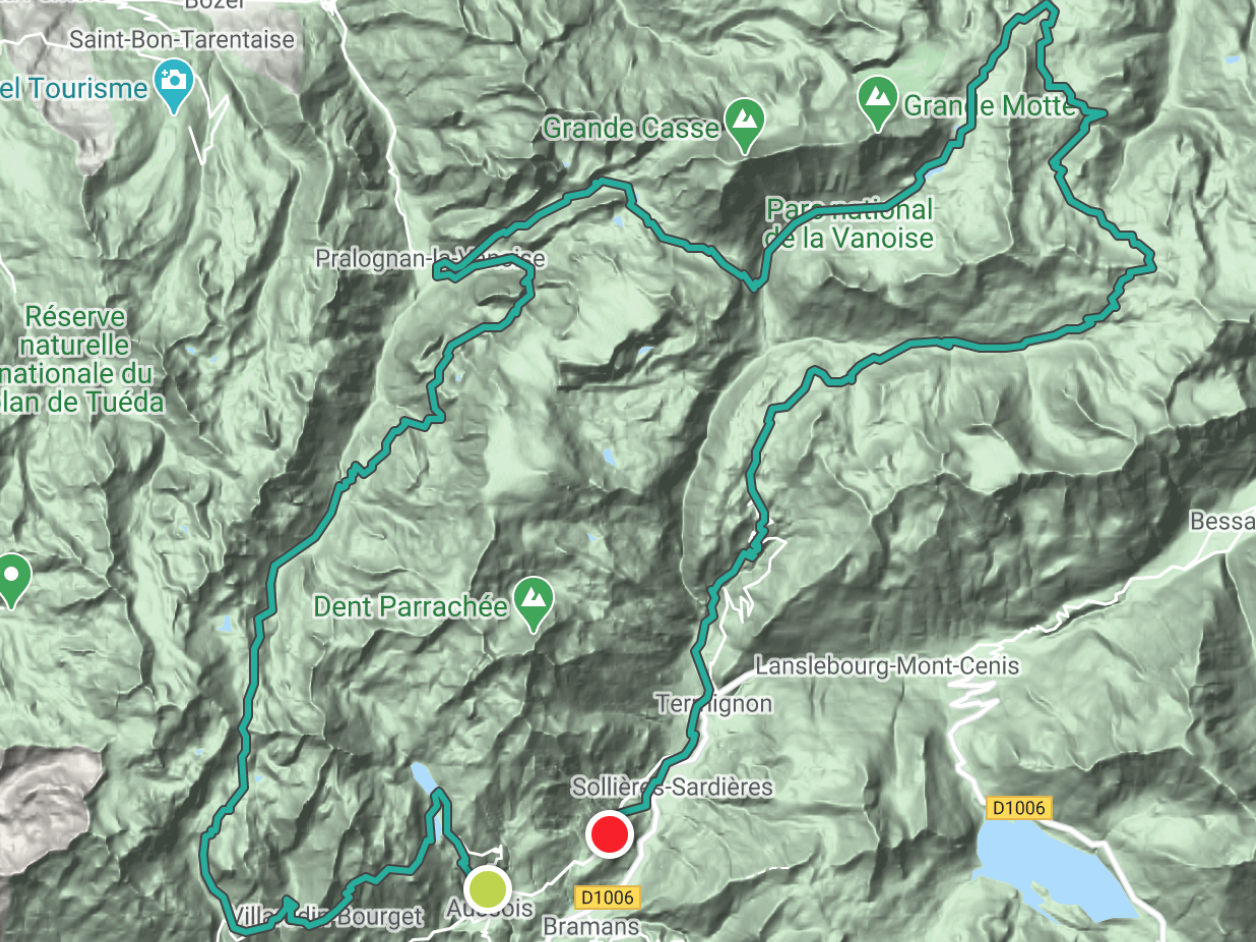
From the leisse mountain refuge to the femma mountain refuge

Day 5: alone in the world

When we wake up, it's raining hard and the temperatures are cool. Only 5°C in the dormitory. But by the time we have breakfast, the rain has stopped and the clouds are already starting to lift. We are definitely riding our luck when it comes to the weather!
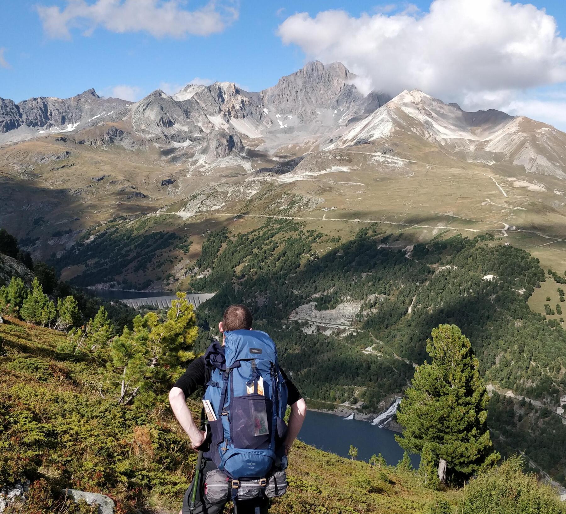
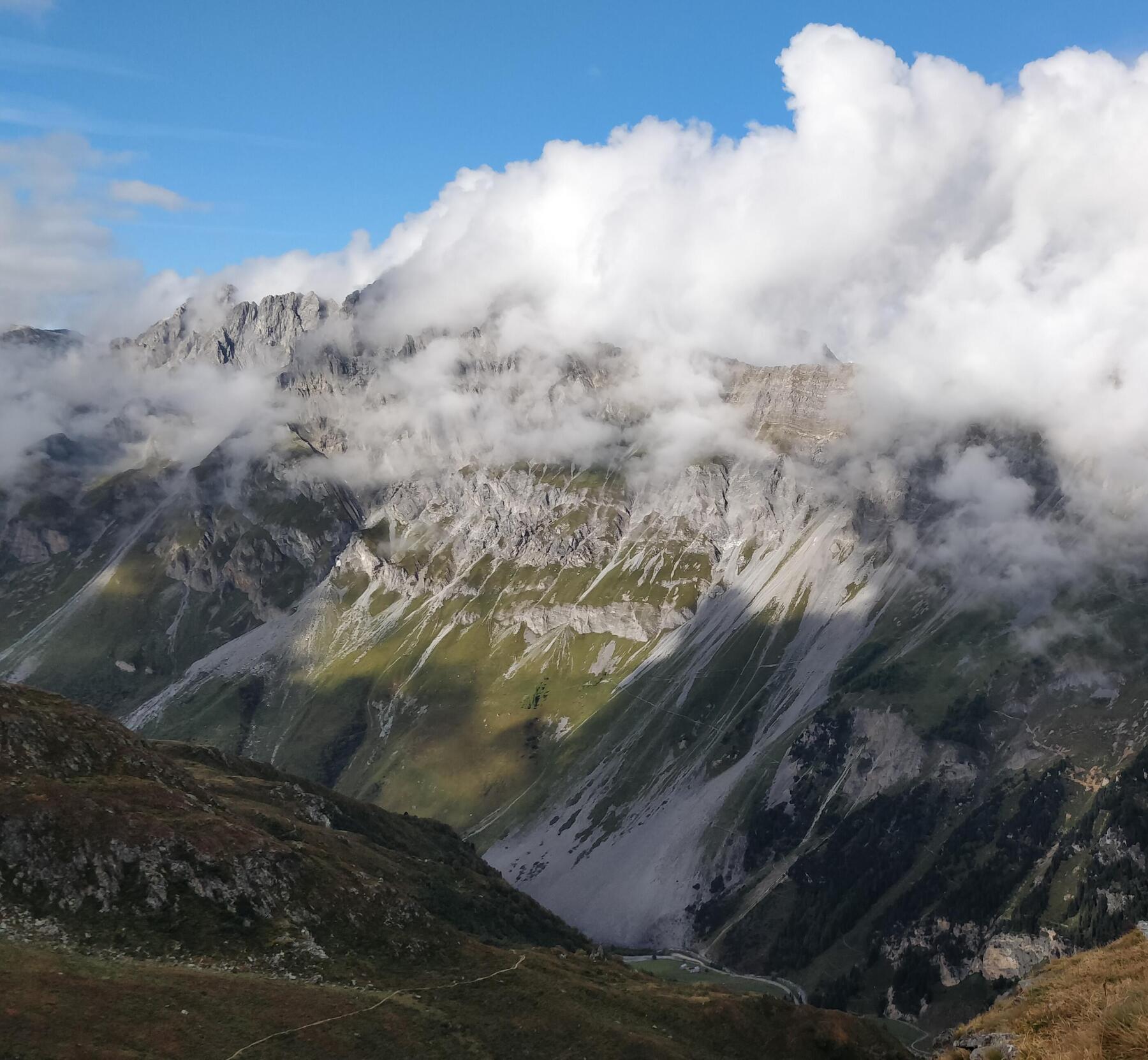
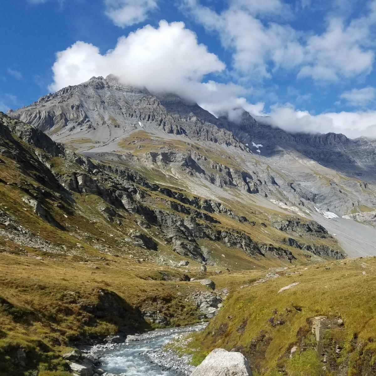
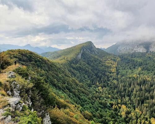
For the temperature, the ascent to the Col de la Leisse is enough to warm us up. The path passes below the Grande-Motte glacier, through some small lakes, some of which are dry.  At the top, the peaks are dusted with the snow of the night.

Once we get over the pass, we are heading towards the Col de Fresse, at the top of the slopes of the Tignes resort. Crossing the ski area, which cannot be avoided, is clearly not the most beautiful part of this trek. The mountain has been disfigured by the ski slopes and, even more so, by the MTB slopes. Fortunately, we soon get to the national park.
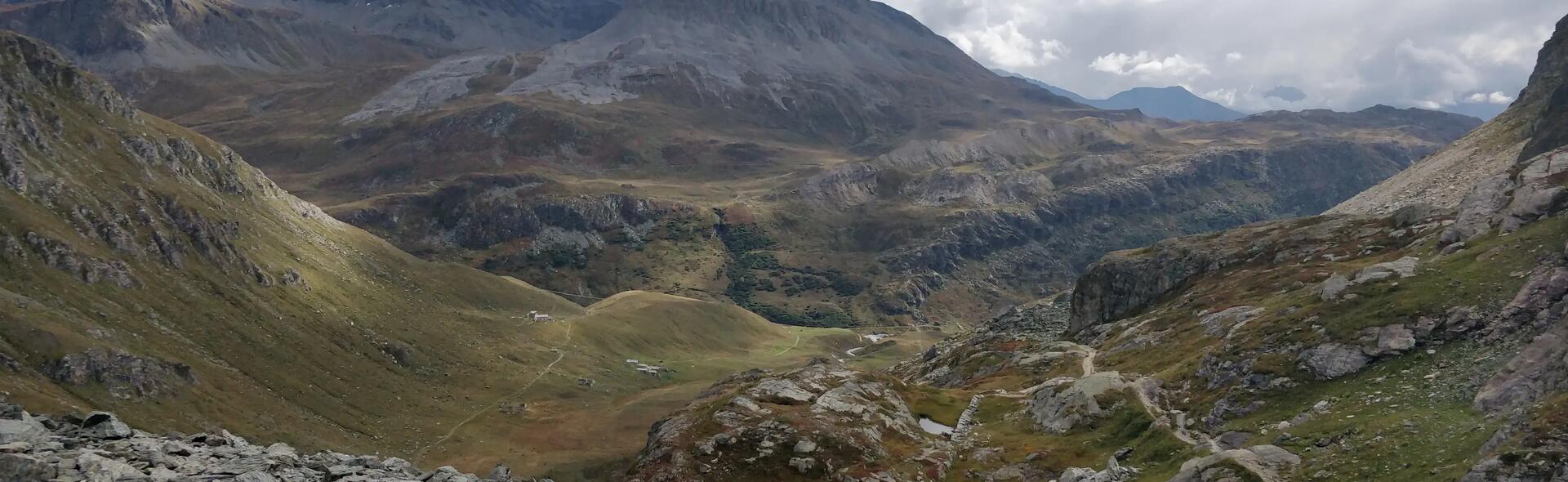
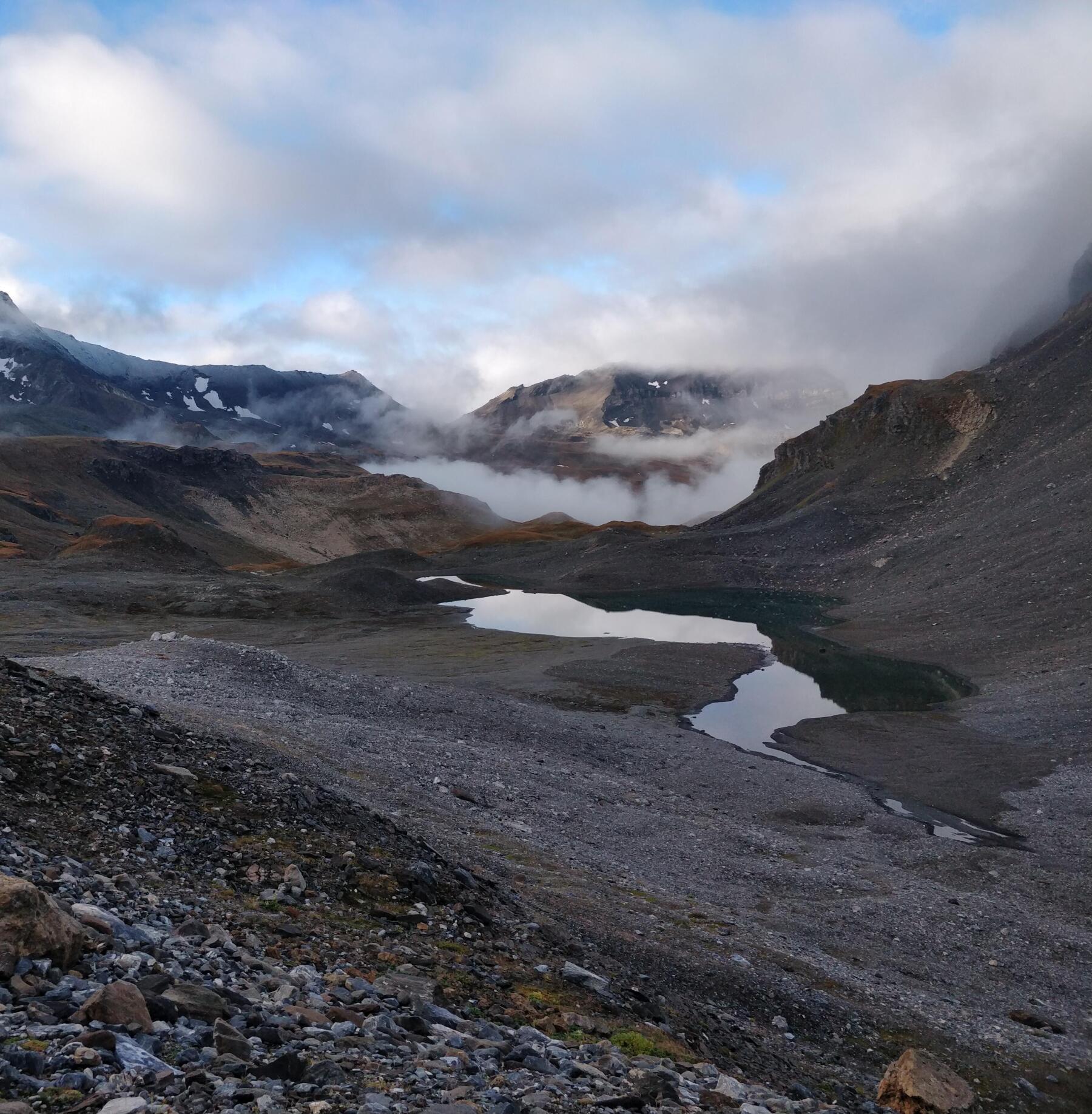
We reach the Col du Roup and then we cross a kind of alpine plateau,interspersed with many small mountain streams that we have to cross on foot. After leaving the mountain refuge, we don't see a single soul. The unspoilt scenery that surrounds us only serves to increase the sense of being completely alone in the world. We feel small and insignificant, and we can only open wide our eyes and take it all in.

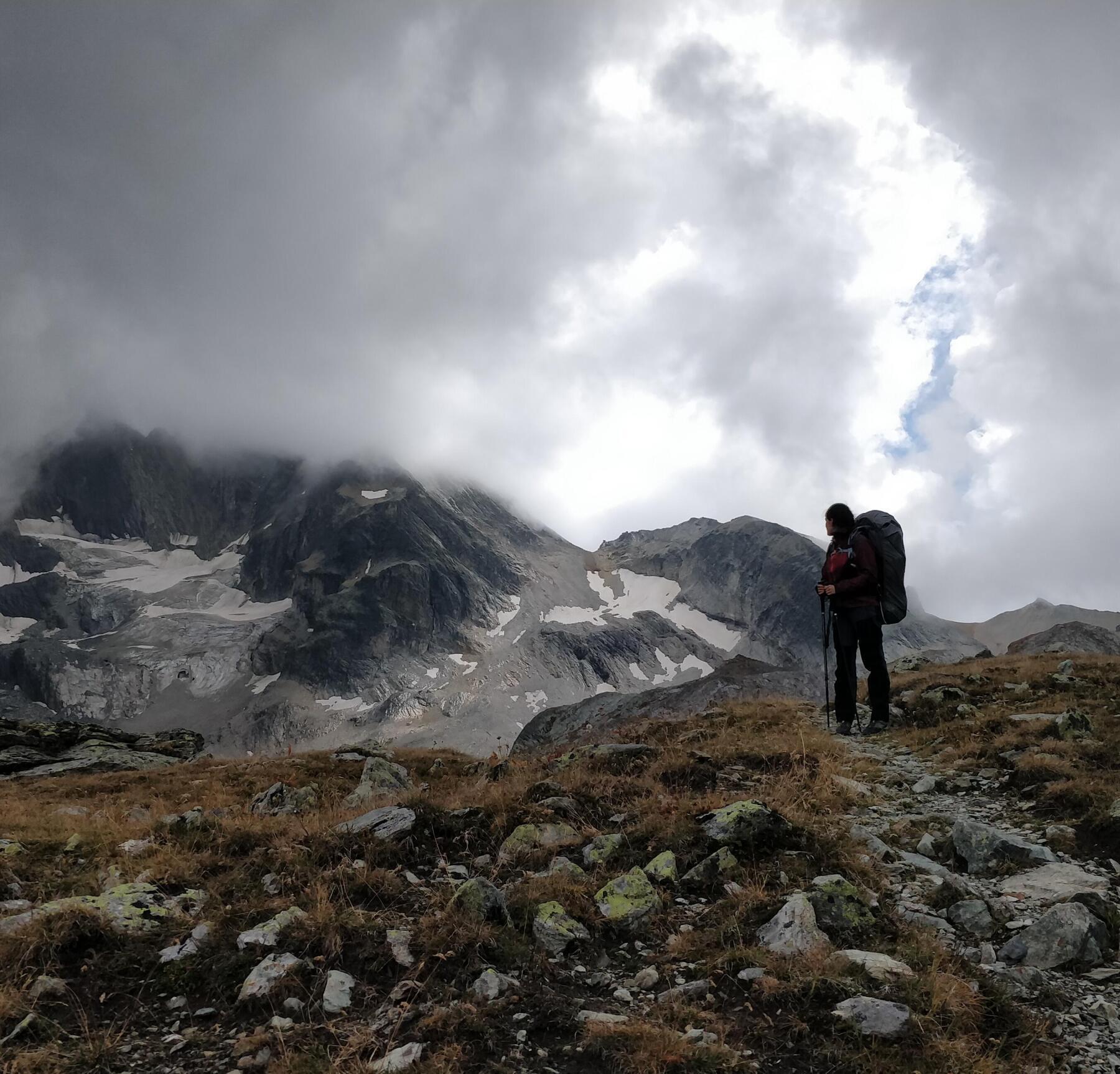
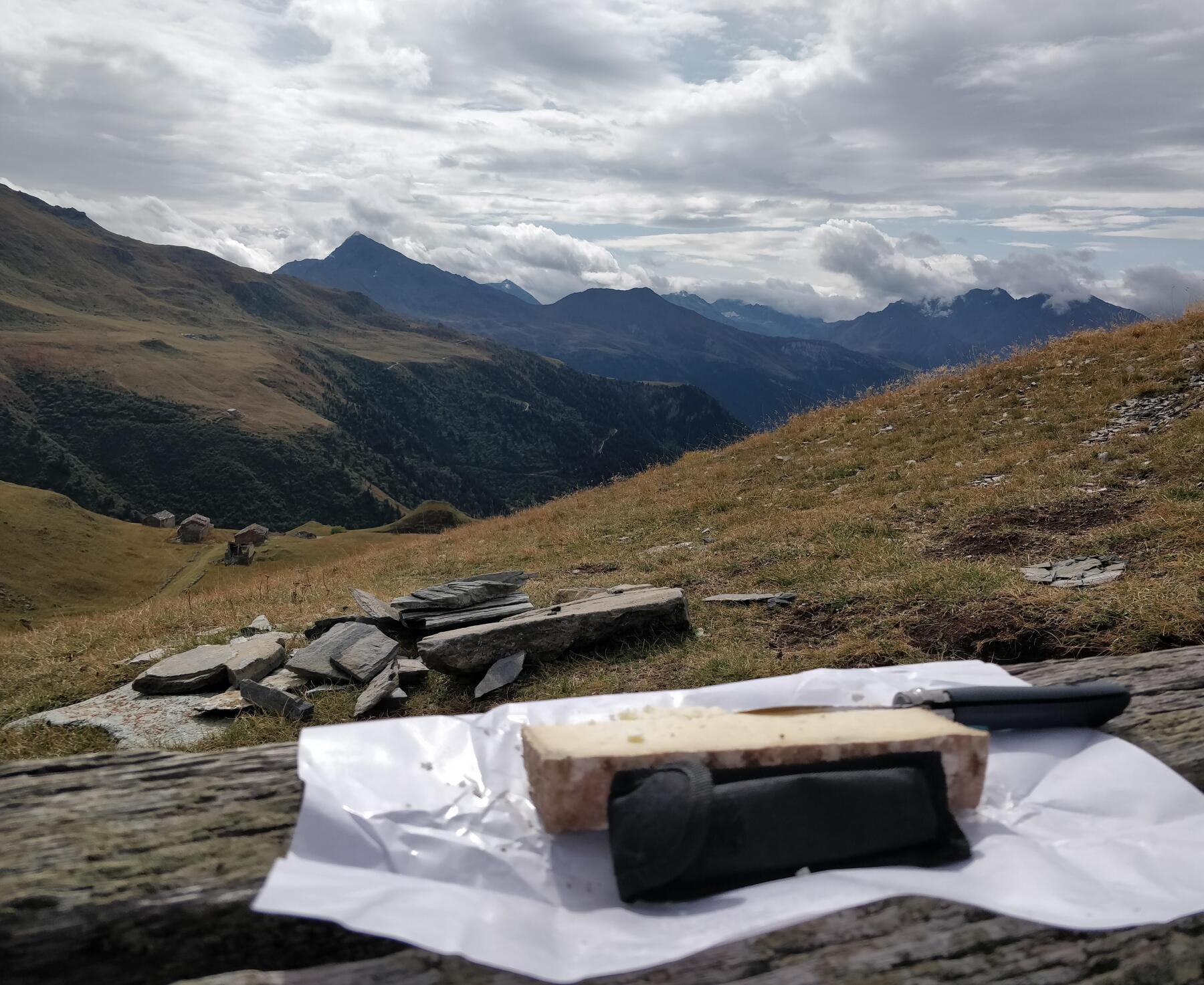
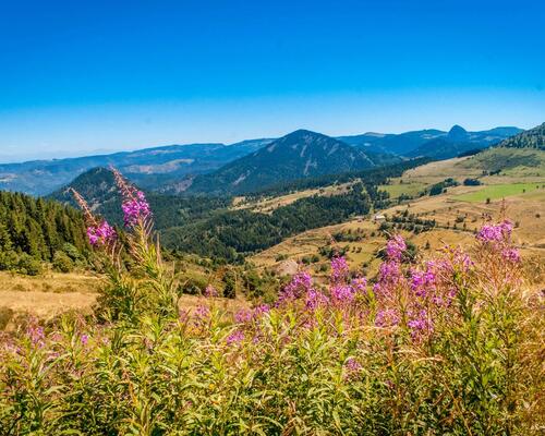
Then, we climb to the Col de la Rocheure, at 2911 m, the highest point of the trek. The climb is gentle to begin with, before the particularly technical near-vertical wall on slippery scree, while carrying a backpack. But once at the top, the view is breathtaking. We enjoy the moment. Finally, we go back down the Rocheure Valley towards the Femma mountain refuge. We are accompanied by scores of marmots, that aren't scared in the slightest, it's bizarre.
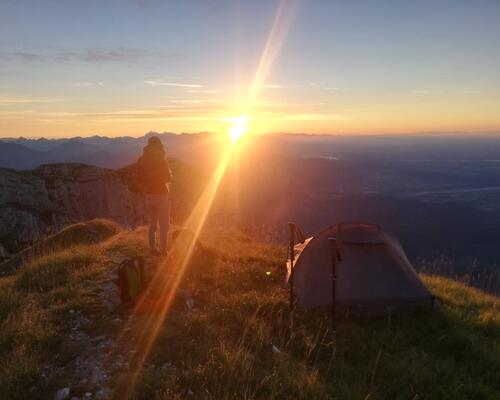
We enjoy the sunset, followed by a meal in the mountain refuge, before setting up our bivouac under a starry sky, for once.

hike femma mountain refuge

From the femma mountain refuge to aussois

Day 6: change of plan

The day begins with a gentle descent, towards Entre-Deux-Eaux, a small hamlet where the Leisse and the Rocheure Valleys meet.

On the way, we meet Jacques, a 73-year-old, with a white mop on his head, who is retired from the French Development Agency and has been living in the Rocheure Valley since he was 60 years old. Sadly, he tells us that there are no cheese dairies among the houses in the mountain pastures. As an alternative, he offers to take us a little further down the road to some cheese-maker friends. We weren't disappointed! On the way, he tells us about life in the mountain pastures and introduces us to a small part of his vast knowledge.
At the cheese factory, the first warning sign came when Ghislaine (the cheese maker) told us that she had heard that the snowfall was actually forecast for that night. Yesterday's weather forecast, however, had predicted that the first snowfall would come tomorrow evening, just after our estimated time of arrival.
On the return trip, Jacques stops to greet the keeper of the Plan du Lac mountain refuge. He confirms, with supporting evidence, that the snow will indeed start to fall from midnight tonight. 40 cm at an altitude of 1500m and -6°C for a month of September, it's no joke.

We had planned to bivouac at the Arpont mountain refuge at 2300 m and the car is parked at 2000 m. It doesn't take long to decide: reluctantly, we change plan. We say goodbye to Jacques and the keeper of the mountain refuge before heading for the Vallée de L'Arc. A long and winding descent awaits us. We still take the time to enjoy the last few miles.

Once we get to Termignon, we have no other choice but to hitchhike to get as close as possible to the car. From Aussois where we're dropped off, we still have 500m of D+ rated hiking in a straight line to reach the car. One last climb to conclude this truly otherworldly trek, which we highly recommend!

As a bonus...

At the heart of the Vanoise mountain range, trekking around the glaciers

The good tips for this trek

Be prepared for when the shops close at the end of the season if you are planning to do some shopping during your hike.

My favourite

Col de la Rocheure. Getting there is challenging albeit magnificent, and the view at the top is breathtaking.

My essentials in the mountains

The Forclaz MH500 trekking poles, which I use for going uphill as well as downhill, especially when the terrain is slippery.

At the heart of the Vanoise mountain range, trekking around the glaciers

Trek experienced and described by adrien

Packaging project manager and adventure enthusiast

His favourite quotation:
"Look deep into nature, and then you will understand everything much better"
Albert Einstein 

More tips and testimonials

trek itinerary in the Alps

Trek departing from Chambéry with a reduced carbon footprint!

Sophie set herself a challenge: to go trekking with a group of people she hardly knew while minimizing her carbon footprint. A challenge that was certainly accepted with this itinerary setting out from Chambéry, offering both magnificent views and burgeoning friendship!

Top 5 hiking routes in Auvergne-Rhône-Alpes

Top 5 walking travel routes in Auvergne-Rhône-Alpes

Discover our best walking travel routes in Auvergne-Rhône-Alpes. Discoveries, thrills and great encounters guaranteed!

Trekking in Italy

Trekking in Italy

Do you dream of touring Italy on foot? Check out our selection of the best hiking or trekking destinations in Italy!