Top 5 hiking routes in Auvergne-Rhône-Alpes

Top 5 walking travel routes in french alps and around

The "Auvergne-Rhône-Alpes" region is full of trails and possibilities for hiking. For a walk, or something more: here is our selection of the best walking travel routes to set off for several days and discover unspoiled nature, wide open spaces, villages and local produce.

Discoveries, thrills and great encounters guaranteed!

Thirsty for adventure and nature in peaceful France? The wide open spaces and villages of French Alps are waiting just for you!
Discover the adventure of walking on long-distance hiking trails and historic routes that cross particularly unspoiled nature between villages, highlands and the mid-mountains.
Along rivers, in the footsteps of pilgrims or through ancient mountain ranges, you’ll also discover some exceptional heritage.

Here is our selection of the 5 best backpacking travel routes in the French "Auvergne-Rhône-Alpes" region, for a different way to travel, on foot and close by, but with the thrill of real adventure!

Stevenson's trail.
with or without a donkey.

This is the very essence of gentle roaming.
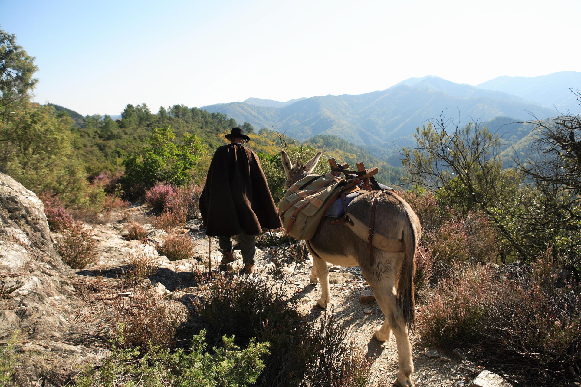
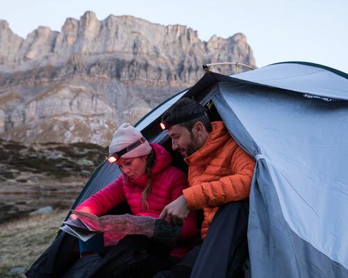
Stevenson, the Scottish writer, and his famous donkey Modestine travelled from Velay to the Cévennes in 1878. They weren't going very fast: they took 12 days to travel 190 kilometres.
The trail named in memory of their epic journey - at the time, this trip was a real expedition - is one of the most popular in France among hikers, who’ve swapped the donkey for a simple backpack, travelling light. But Modestine’s descendants can still be found on the GR 70.

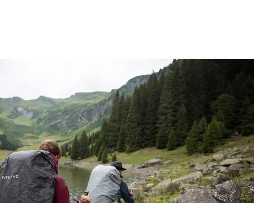
At a donkey’s pace, the journey becomes easier: the luggage is transported by your donkey friend, its calm pace inviting us to indulge in a little contemplation. You better appreciate the beauty of the wide open spaces of Velay, which welcome you as soon as you leave the town. Now you’re walking, to the sound of boots and hooves, through a very green setting, highlighted by the ochre and black of the hamlets built of lava stone, between fields of lentils.
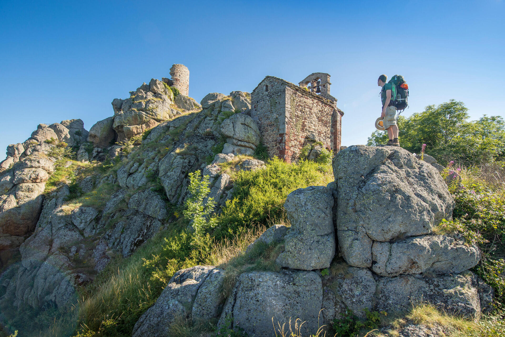
In beautiful villages such as Bouchet-Saint-Nicolas and its lake, or Pradelles and its old town, people are more likely than ever to come up to you, thanks to the presence of your long-eared companion.
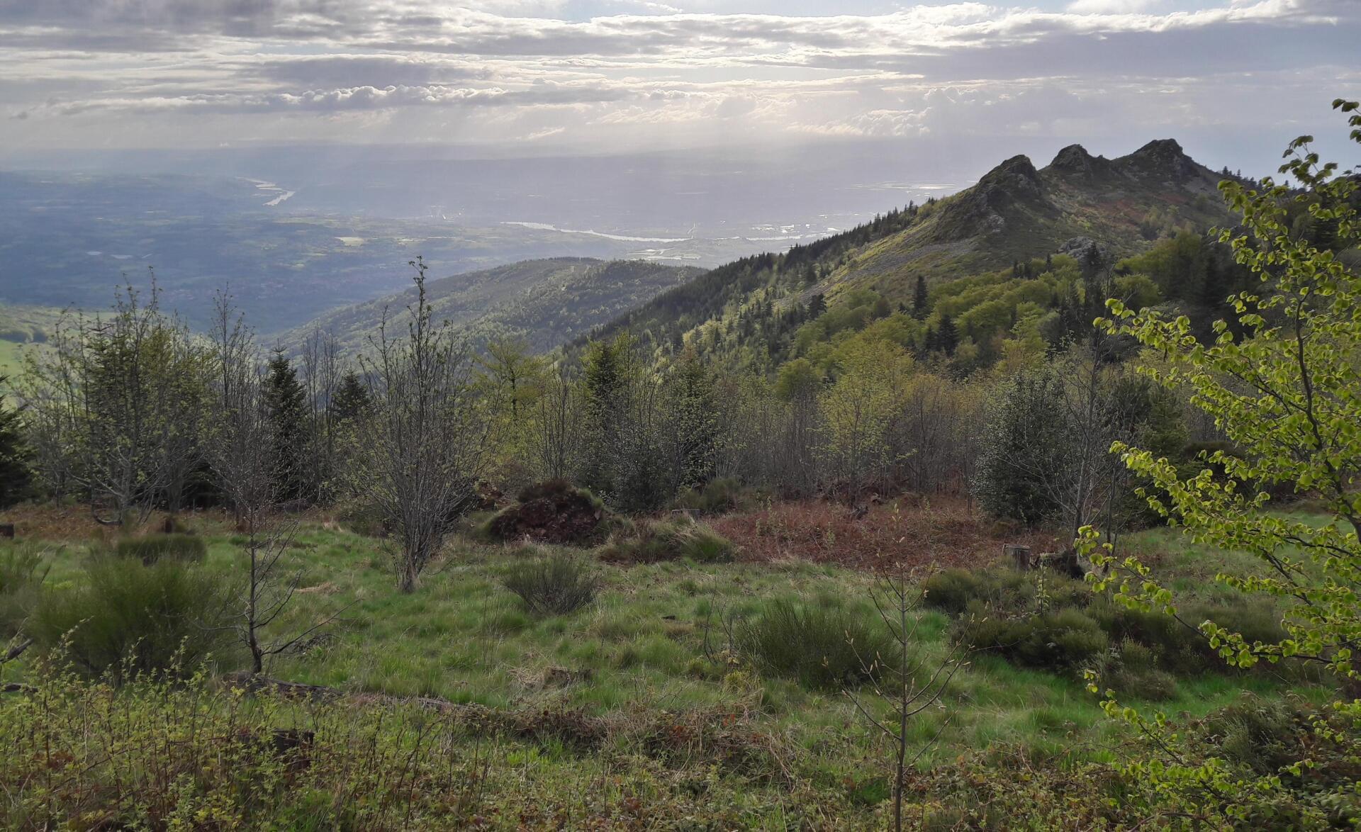
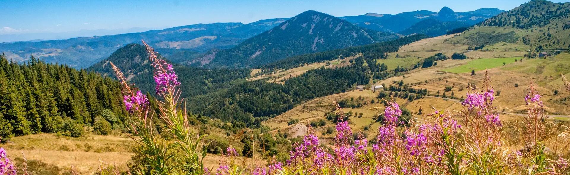
After Velay, you approach the Gévaudan, its little valleys and woods, to pass into the Occitanie region.

The experience of the journey can be enjoyed even better with family. The donkey, a gentle companion on the trip, is immediately adopted by the children, ever eager to walk alongside it. Looking after it also brings people together, and stops provide an opportunity for lots of hugs. Like Stevenson, you’re sure to fall in love with your companion with its sweet gaze!


Some information about the GR®70:
- 250 kilometres: the length of Stevenson's Trail. 75 kilometres in Auvergne-Rhône-Alpes.
- 40 kilograms: the load a donkey can easily carry.
- 4 km/h: the donkey’s walking pace
- Recommended period: April to October

stevenson’s trail hiking route

The way from puy-en-velay to santiago,
the wide open spaces to compostela.

The Via Podiensis, which starts from Puy-en-Velay, remains undoubtedly the most beautiful route to discover everything that makes the Santiago routes so wonderful: a fine diversity of landscapes, architectural treasures, authentic villages and great encounters.
Here, you’re in “sweet France”, rural and unspoiled, where pretty villages follow natural expanses, where churches are often Romanesque and where, in addition, you can eat so well! The charm of this trail, which remains the most widely used and famous French route to Santiago (it was marked in its current form as early as 1970), is truly unique.
The first stages mark us out as a pilgrim by plunging us into the vast expanses of Velay, where the mind already wanders between contemplation and introspection.

The highlands of Velay and then Margeride follow one another. The walking here is easy, the gaze fixed on an infinite horizon or whatever catches the eye in these immense tracts: a grove, more likely a herd, an isolated shepherd’s hut, a cross that’s defied the weather for centuries, the wind blowing unhindered.

Some sections have become mythical places along the way and again and again bring rare, unforgettable moments. Thus, Domaine du Sauvage, a place which more than aptly bears its name, is reached, three days after Puy-en-Velay, on the ridges of the Margeride. Its inn and lodge, nestled on the plateau, are a welcome refuge when the elements are against you, or just for a simple break in the middle of a long day’s walking in the sun.

The memory of the beast of Gévaudan still roams these vast wild plateaux, even if it’s now just a pleasant effigy on village sculptures, like the one that seems to watch over Saugues, the historic capital of Gévaudan, where you can admire the old houses dominated by the Tour des Anglais, a 13th-century square keep.
Further on, you reach Aubrac, a real steppe in the heart of France where the cows have pretty eyes and the flowers in spring put on a real fireworks display to celebrate your passing!


Some information about the GR®65:
- 210 km between Puy-en-Velay and Conques
- The Auvergne-Rhône-Alpes region offers lots of other routes to Santiago: the Geneva Route (Via Gebennensis), Lyon Route (Cluny-Lyon-Le Puy), Via Arverna from Clermont-Ferrand … wonderful less known options are yours to discover!
- Recommended period: April to October

Santiago de Compostela hiking route - photo credit Olivier Rochegude

The "grande traversée du jura",
gentle mountains.

The Jura isn’t the Alps. Its relief is less impressive, its landscapes undoubtedly more gentle. Vast plateaux interspersed with cliffs and spectacular remote areas. The ascents and slopes, present but accessible, also make it particularly suitable for relatively easy hiking and walking.

No wonder the Grande Traversée du Jura and other routes attract a large number of hikers here.
The GTJ starts in the north near Montbéliard, in the Bourgogne-Franche-Comté region, before descending to the banks of the River Doubs. You then head back up to the Mont d’Or, 1463 m, where the view of the Alps is fantastic.

But it’s when approaching the Auvergne-Rhône-Alpes region and the Ain department, after the Valserine Valley, that the highest peaks of the French Jura await before a city stopover in Bellegarde-sur-Valserine. You then head up to the mighty Plateau du Retord, where the flowering meadows, covered with daffodils in spring, plunge you into a truly bucolic setting.

The ridges then offer a succession of breathtaking views, over the Alps, Lake Geneva in the distance and over the Rhône valley. As a highlight, arriving at the summit of Grand Colombier offers an apotheosis of this unforgettable hike where you can also taste the rustic sweetness of the accommodation, a real mix of guest houses. The heritage aspect isn’t forgotten since you can admire numerous examples of rural architecture and discover the majestic Charterhouse of Arvière, built in a “desert” as sought after by the monks who so loved solitude and silence.
Once you taste the gentle nature and calm of these Jura mountains, you’ll also appreciate the meetings and shared dinners along the way.


Some information on the GTJ:
- 394 km of walking
- Difficulty: a long hike which, even though it takes place on good trails, is demanding in terms of duration and height gain.
- Recommended period: May to October

grande traversée du jura hiking route - photo credit V Sergent

The régordane path, at the heart of tales of french history.

Medieval pilgrims who worshipped the black virgin of Puy-en-Velay then walked south to head for Rome. This route, today signposted from Puy to Saint-Gilles-du-Gard, was also an important trade route, a mule trail nicknamed “Chemin de la Régordane”, part of one of the greatest pilgrimages of medieval Christendom, the Saint-Gilles Way.

There are many records of these travels, Christian or civil monuments, as well as traces of cart wheels on the old stone roads; the Régordane follows a geological fault that’s been used since the dawn of time.
Villages with exceptional heritage follow one another along the route. Throughout the Haute-Loire and the Ardèche, it’s worth mentioning Pradelles, classified among the “most beautiful villages in France”, or La Garde Guérin, in Lozère. A rich rural heritage is yours to discover all along the route: fountains, picturesque hamlets, common ovens … there are so many surprises!

The balance between heritage and nature also characterises this trail:in Auvergne-Rhône-Alpes, you cross the wide open spaces of Gévaudan, before admiring the slopes of Mont Lozère and the crests of the Cévennes with their forests of contrasting light, then approaching the vineyards and orchards of the Midi, as far as the Camargue. A great diversity of landscapes across an often unknown France for you to discover through the stories of Régordane: in the footsteps of the Marquis de La Fayette, William of Orange, Sergei Prokofiev, Alphonse Daudet, Coco Chanel and even the Cévennes journalist writer and filmmaker Jean Pierre Chabrol, Jean Cavalier the Camisard chief and so many other locals… Some information on the GR®700:
- 242 kilometres of walking
- 2 departments of Auvergne-Rhône-Alpes passed through.
- Difficulty: a fairly accessible mid-mountain route with moderate height gain.

hiking route regordane trail - photo credit Luc Olivier

Gr®7: on the ridges of the watershed.

The GR®7 is a very long trail that follows the watershed between the Atlantic Ocean and the Mediterranean: over 1500 kilometres along the ridges!
Starting from the Vosges and continuing to Andorra, it offers above all an extraordinary crossing of the Massif Central in Auvergne-Rhône-Alpes, from the little-known Beaujolais mountains to the sources of the Loire and the ridges of the Monts d'Ardèche.
With points of view along the ridges, villages and natural sites, there are many surprises along the way. You first discover the astonishing Beaujolais landscape, its green mountains dominating the famous vineyards and its small villages with their golden stone. Further on, the Lyonnais Mountains also bear the same colours, again with a wonderful roller-coaster profile! You then approach the Massif du Pilat, its ridges and extraordinary panoramas over the Alps, which you reach after some good rocky slopes. Further south, you approach the slopes of Mont Mézenc, then those of Mont Gerbier-de-Jonc and the Monts d'Ardèche, between volcanic cores and high plateaux of large flower-filled spaces.

The route winds along the ridges, along the borders of departments and massifs: this natural division also marks out the watershed line. The path is generally in the heart of nature, wild, revealing the beauty of the discreet massifs where great rivers are born: in particular, you pass very close to the sources of the Loire. The water, which flows towards the seas and sculpts the land, guides us through this secret France.
You can of course approach it in sections and treat yourself to one or two weeks of discovery, particularly through the Regional Natural Parks (PNRs) of the Massif Central, in particular in the Auvergne-Rhône-Alpes region, the Pilat Regional Natural Park and the Ardèche Mountains Regional Natural Park.
The GR®7 has been upgraded in recent years: trail running course, new topo-guides, several actions are being carried out to bring this great route back to life.

Among them, on the Monts d'Ardèche Regional Natural Park, a series of particularly interesting artworks because they highlight, even materialise in a poetic way, the path and especially the watershed line it follows.
The artistic “Watershed” route brings together six works by six artists, yours to discover on the GR®7 in Ardèche, over 120 kilometres. Focal points, a lighthouse, an anamorphosis, a water tower and other works are scattered along it. A poetic journey, guided by GPS, with furniture along the way made from local materials complete this artistic experience.


Some information on the GR®7:
- 1500 km from the Vosges to Andorra
- A unique way to discover the natural parks of the Massif Central:2 regional natural parks passed through in Auvergne-Rhône-Alpes: Pilat and Monts d’Ardèche
- 4 departments passed through: Rhône, Loire, Haute-Loire, Ardèche
- Recommended period: from April to October
- Difficulty: a wild route, with well-marked slopes.

GR7 hiking route - photo credit Florian Olivier
Top 5 walking travel routes in Auvergne-Rhône-Alpes

Auvergne-rhône-alpes region

This selection of 5 backpacking trips is brought to you by the Auvergne-Rhône-Alpes region, which still has a multitude of other destinations for you to discover.
To do so, visit their website!

More tips

What's the right way to lace up you

What's the right way to lace up your trekking shoes?

Comfortable feet come from having properly laced shoes. Here's how you do it.

Having a period when on a long hiking trek

HAVING YOUR PERIOD ON A TREK

Are you hesitating about going on a trek because you’re due to have your period during the trip? The girls from team Forclaz, are on it and share with you their solutions for trekking even when you have your period!

choosing high trekking boots

How to choose high trekking shoes

You are going on a trek and you need a pair of boots! But you need more detailed information to be able to choose them.You are in the right place!

Feathers or wadding teaser

HOW TO CHOOSE BETWEEN FEATHERS AND WADDING?

Are you having trouble deciding between a feather-filled or a wadding product for walking? Discover the benefits of each of these materials!

rain trek wet dry

Rain protection when trekking

Setting off when it's raining or threatening to rain just means you have to be well equipped! It is often said there is no bad weather, only bad equipment.